Laugavegur
Description
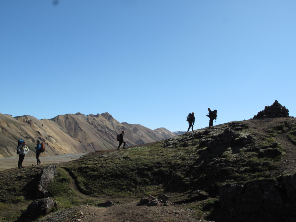
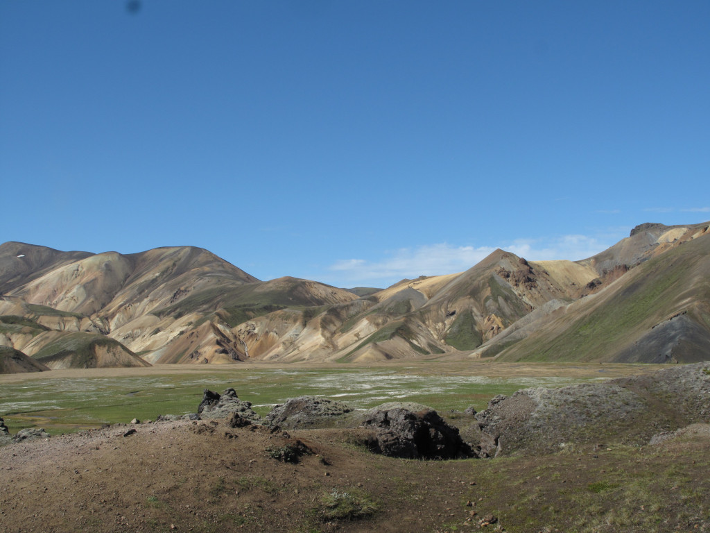
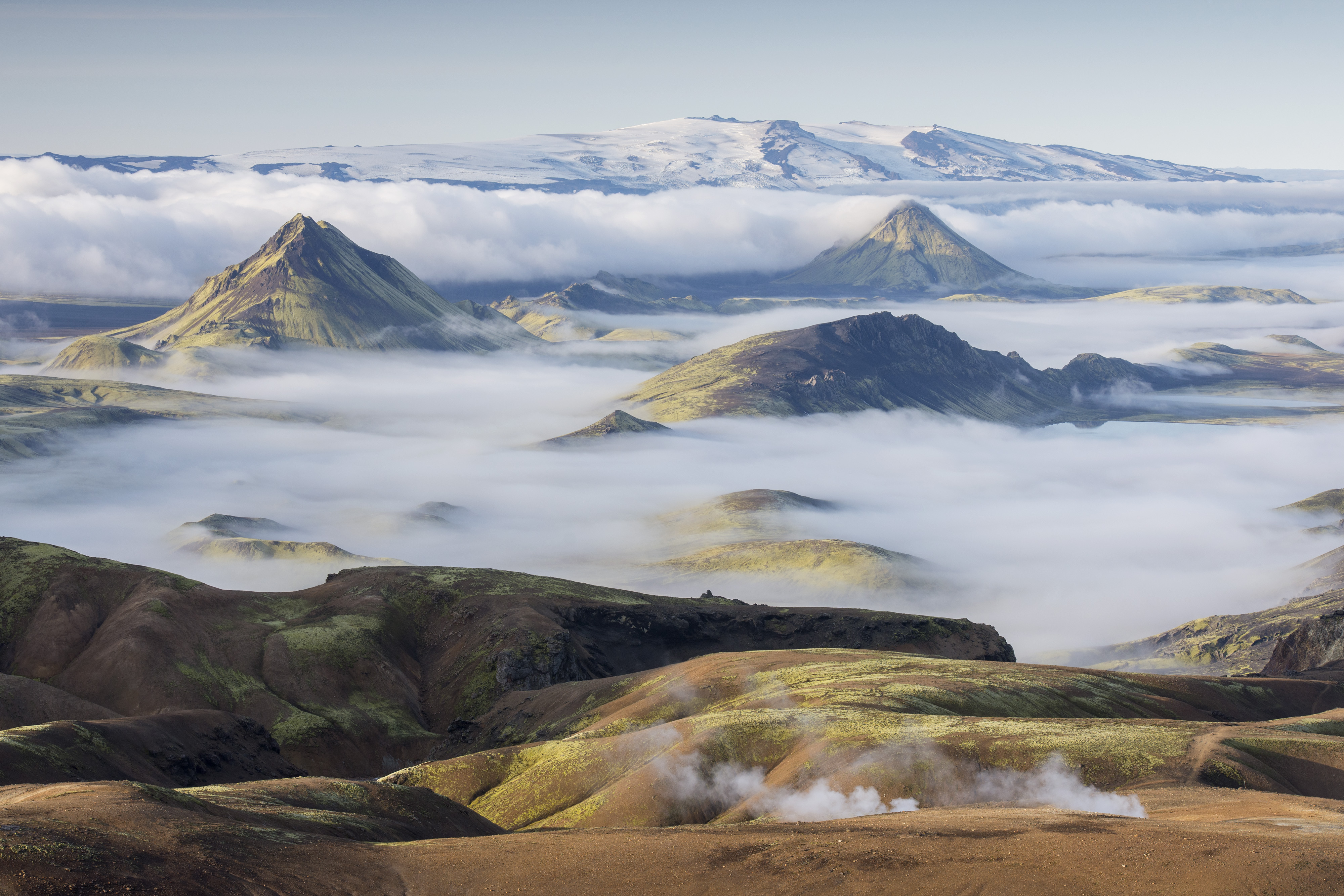
Take a memorable hike along Iceland's Laugavegur trail. This 55-kilometer route is known for its stunning scenery, featuring a variety of landscapes. You'll start in Landmannalaugar, with its colorful mountains and hot springs, and pass through valleys and volcanic deserts.
Along the way, you'll see black lava fields, clear lakes, and finish in the forested area of Þórsmörk. The trail is recognized by National Geographic as one of the world's most beautiful.
Whether you're an experienced hiker or just love nature, the Laugavegur trail offers amazing views and diverse terrains. Prepare to be amazed by the ever-changing scenery and the raw beauty of Iceland's highlands.
Landmannalaugar - Hrafntinnusker
12km. 4-5 hours. 470m ascent.
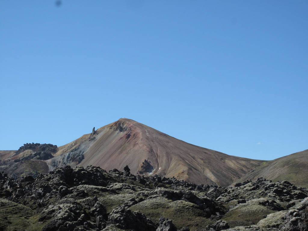
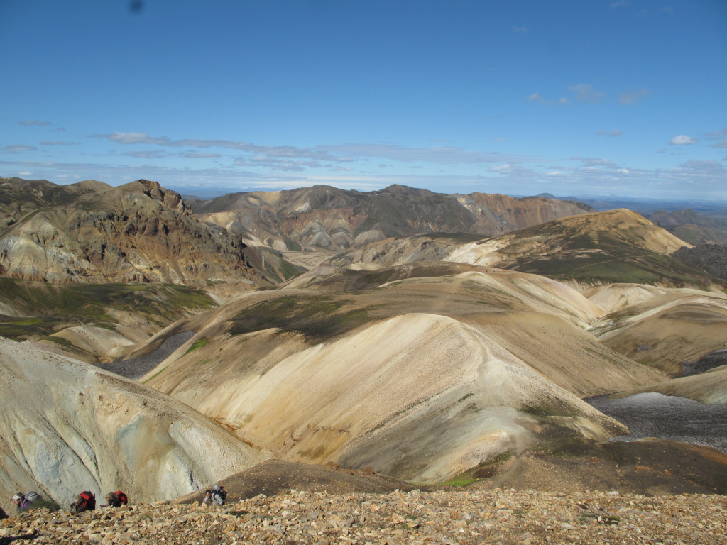
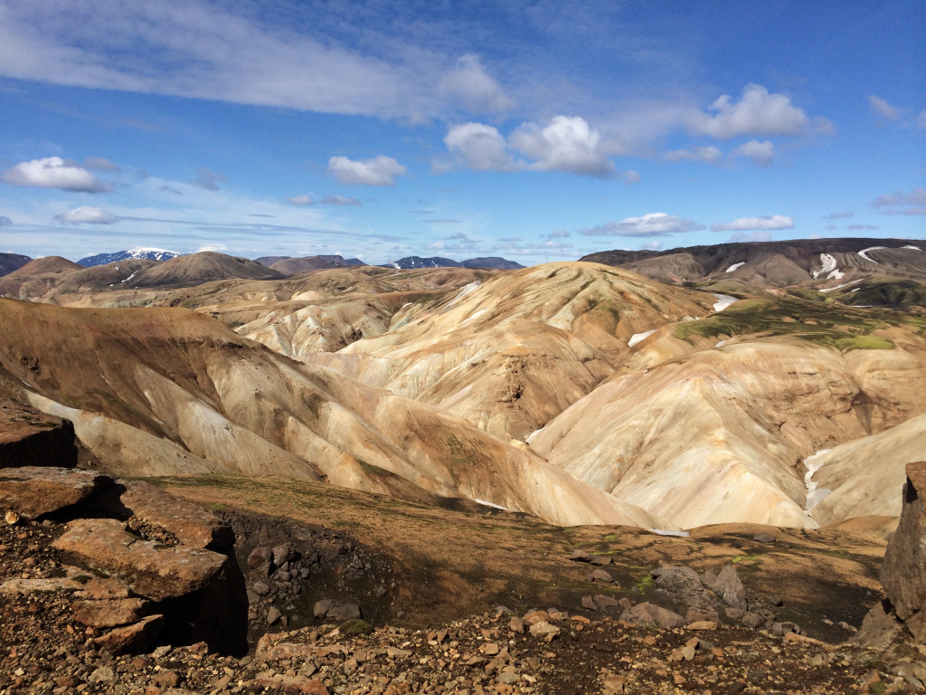
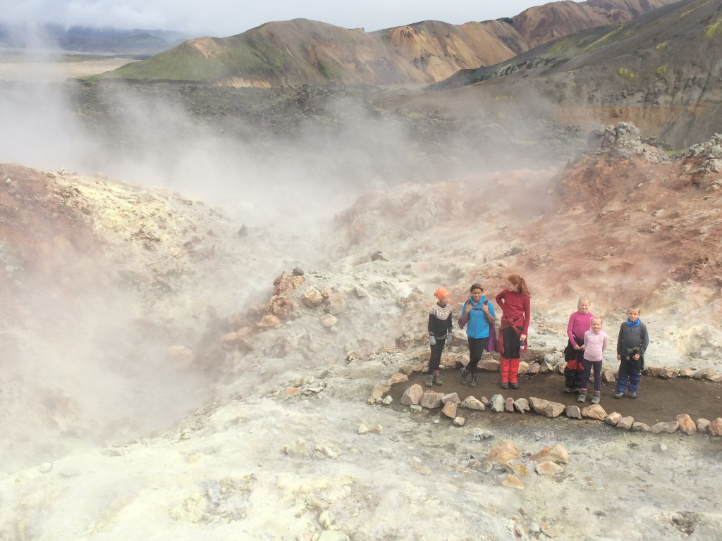
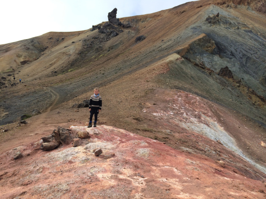
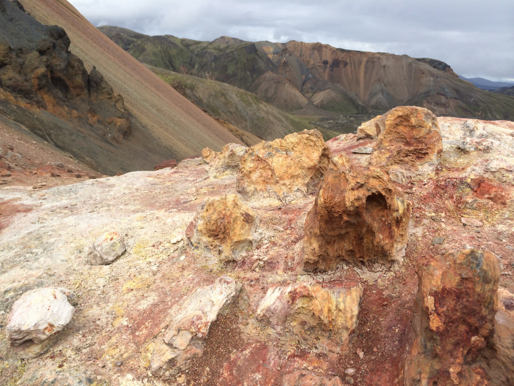
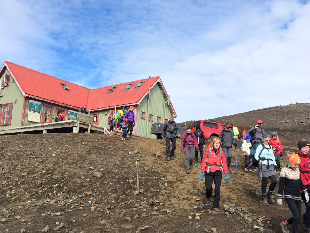
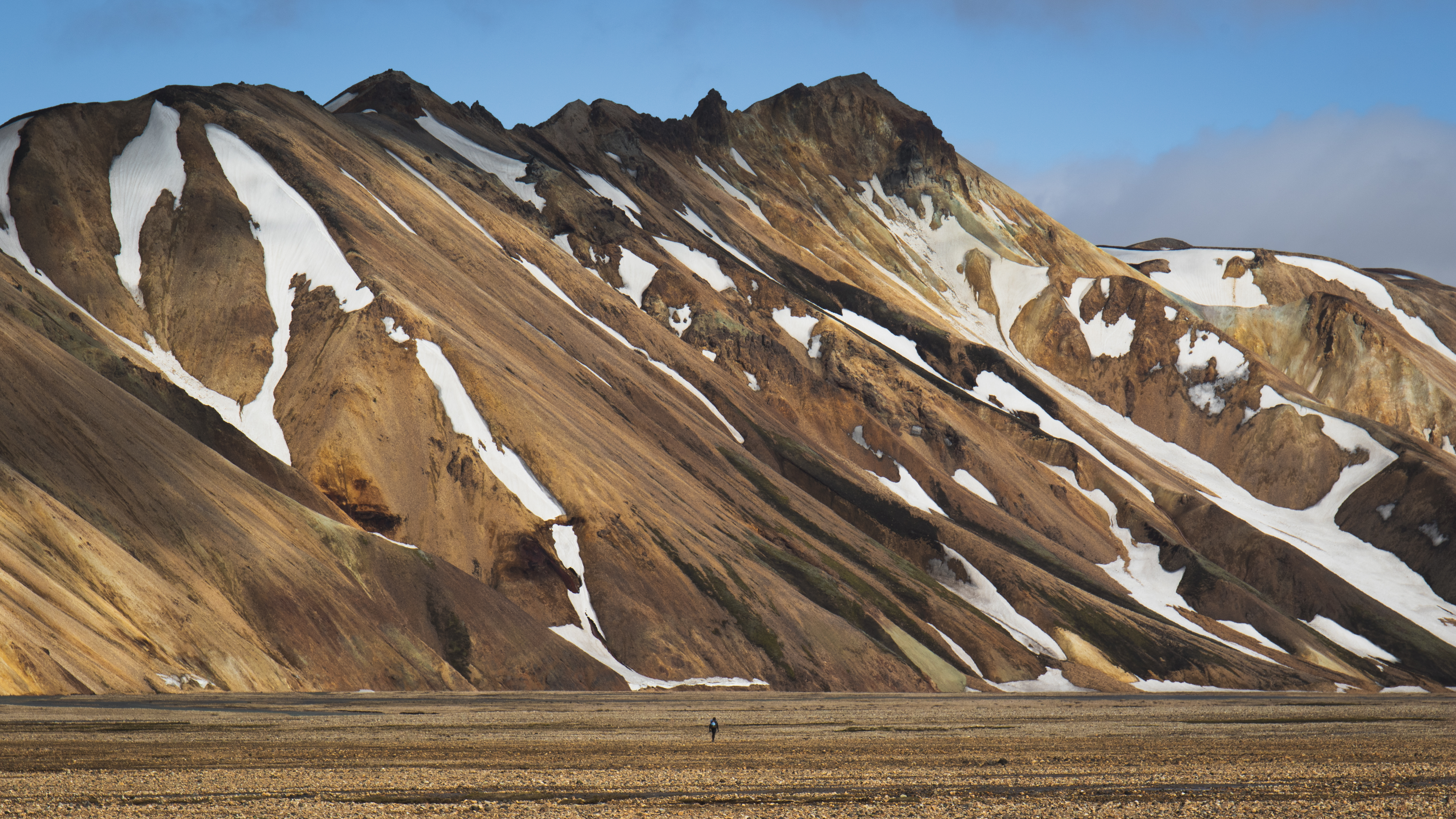
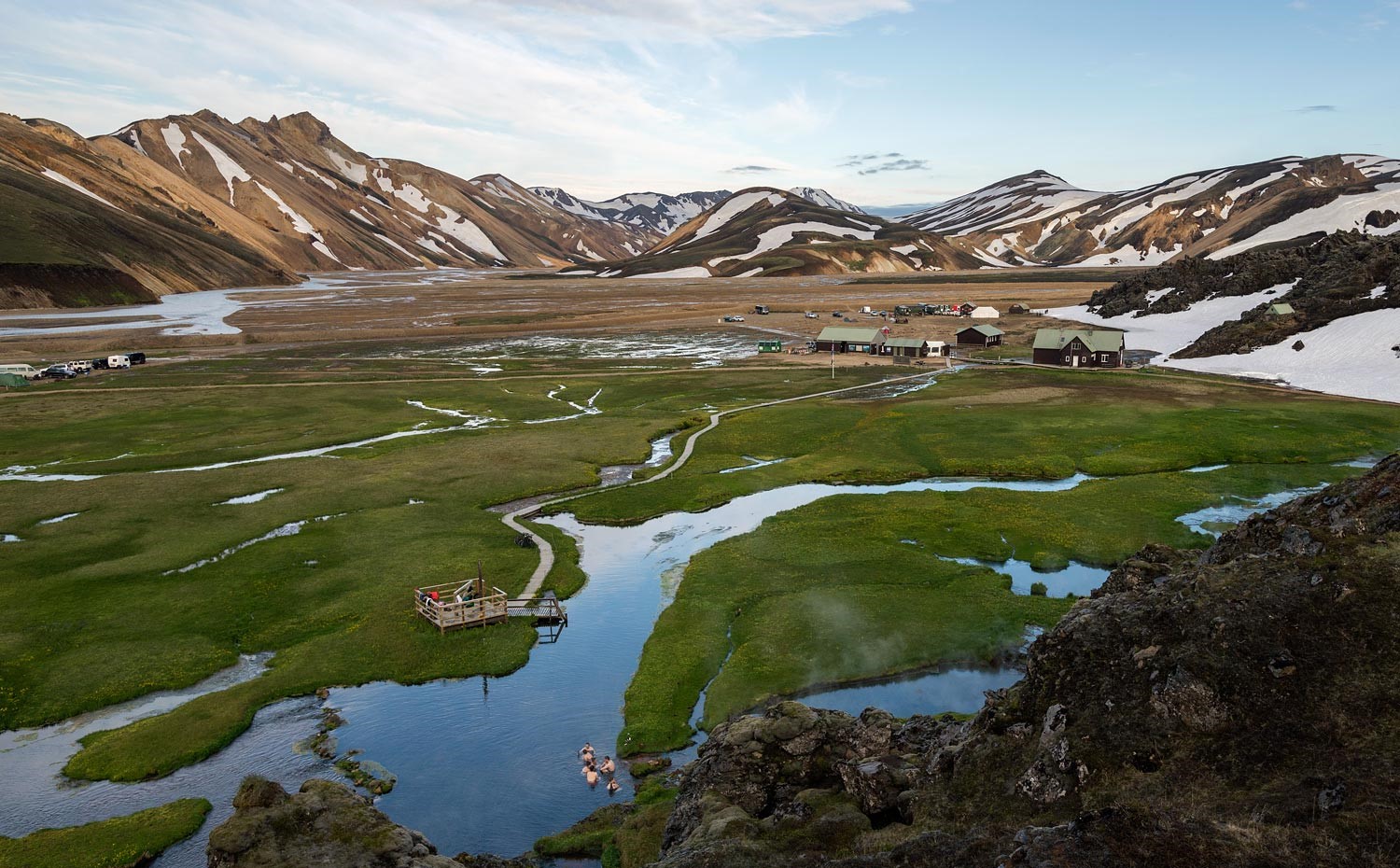
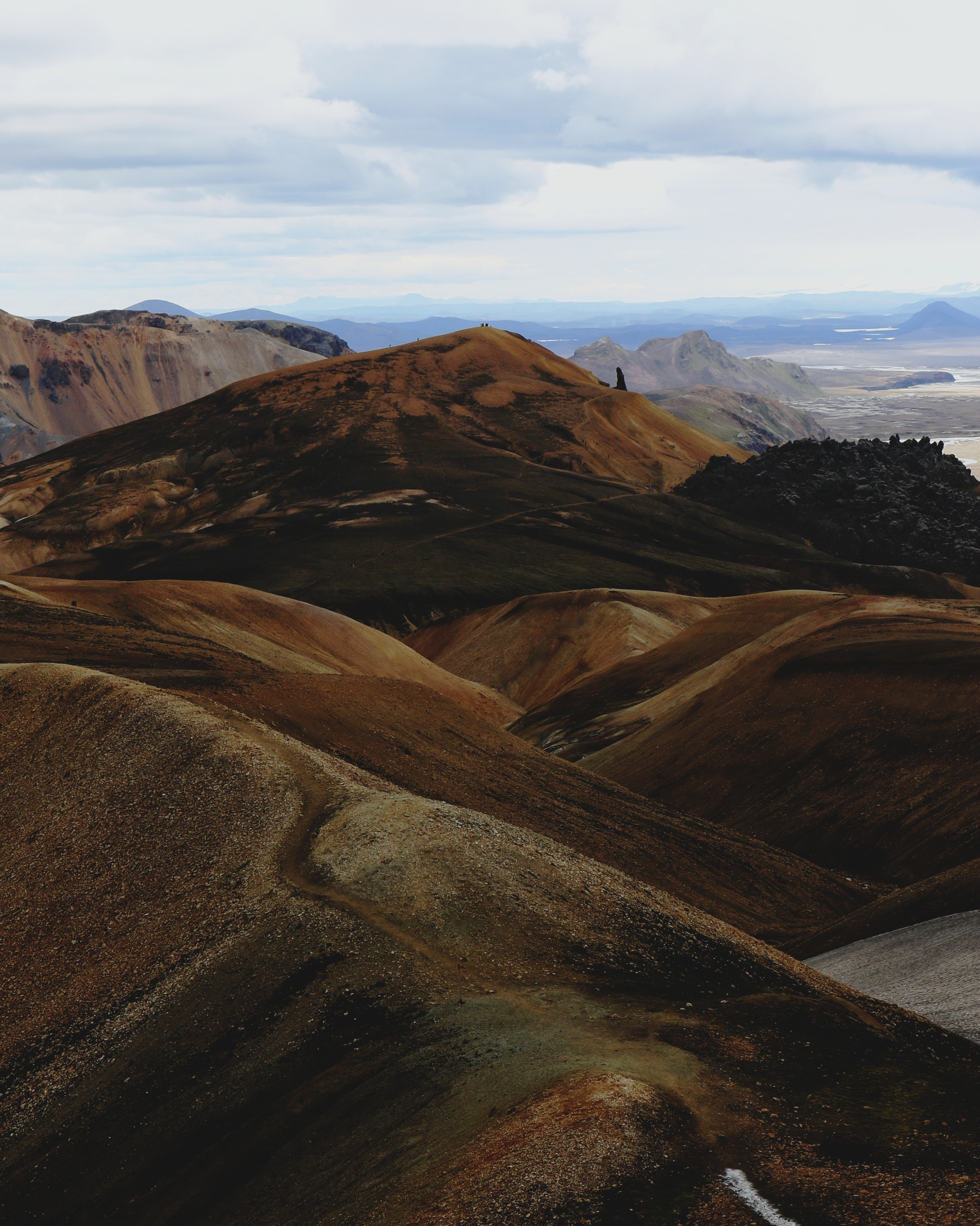
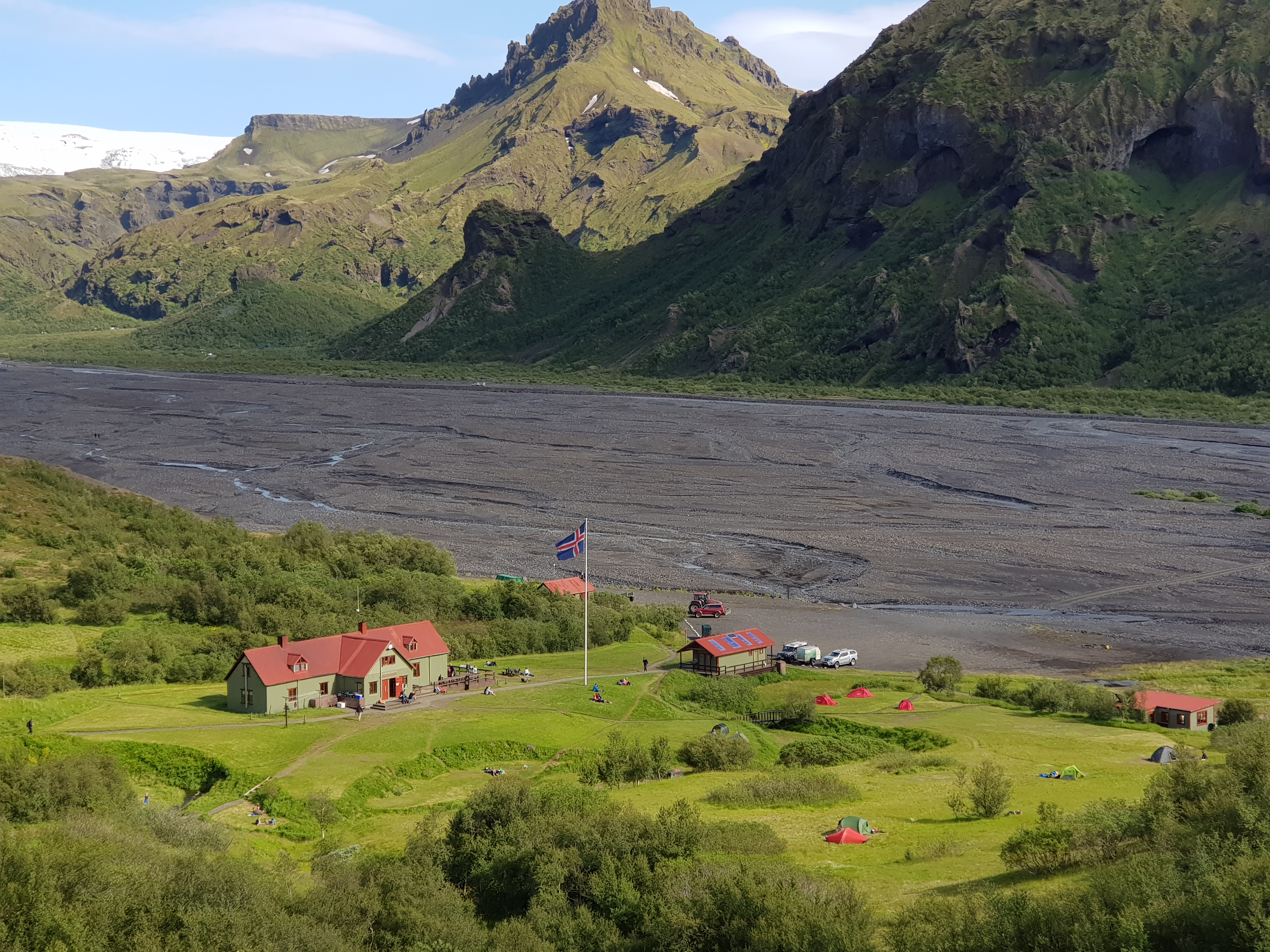
Landmannalaugar is a paradise for nature lovers and adventure seekers. This region is renowned for its colorful rhyolite mountains, geothermal hot springs, and diverse hiking trails. Many people choose to spend some time in Landmannalaugar before starting the Laugavegur trail.
Landmannalaugar accommodation
- The hut: Landmannalaugar hut accommodates 78 people. The kitchen is equipped with gas stoves, utensils and cold running water. The hut is surrounded by a patio, which connects to the information point and bathroom building.
- The campsite: It is very important to camp in the designated camping area to protect the environment. There are sinks for doing dishes and getting drinking water in the campgrounds. The bathrooms and showers are by the information point.
Garbage disposal: You can throw away your garbage in Landmannalaugar.
Things to do in Landmannalaugar
Short hikes:
Laugahraun lava field circle
- Distance: 5 km
- Time: 2 hours
- Difficulty: Easy
- Desciption: The Laugavegur trail takes you through Laugahraun, so this trail is better suited to those only visiting for the day. The loop is one of the easier hikes in Landmannalaugar, gradually gaining a little elevation and giving hikers views of the surrounding rhyolite mountains.
Brennisteinsalda - Laugahraun circle extension
- Distance: 3,5 km
- Time: 1 hour
- Difficulty: Moderate
- Description: Combining Brennisteinsalda with the Laugahraun loop provides a diverse hiking experience. Brennisteinsalda, which translates to ‘Sulphur Wave’, is known for its vibrant colors, originating from sulphur spots on its slopes. The summit offers great views of the surrounding mountains.
Bláhnúkur
- Distance: 10 km
- Time: 3-4 hours
- Difficulty: Challenging
- Description: Bláhnúkur is a fantastic hike for those looking to experience some of the best views in the region. The trail is well marked and easy to follow but can be steep and challenging at times.
Longer hikes:
Ljótipollur
- Distance: 13 km
- Time: 5-6 hours
- Difficulty: Moderate
- Description: Ljótipollur is an explosion crater and crater lake located in the Fjallabak Nature Reserve. The trail is relatively easy and suitable for most hikers, though it is longer than many other hikes in the area. Ljótipollur is known for its red and black volcanic rock, and the deep blue lake in the bottom of the crater.
Skallahringur
- Distance: 15 km
- Time: 6-8 hours
- Difficulty: Challenging
- Description: Prepare for a full day of hiking when undertaking Skallahringur. The trail takes you through everything that the area has to offer, including rhyolite mountains, lava fields and geothermal areas. The view from the top of Skalli, which the loop is named after, is stunning. This hike is often better later in the season, when most of the snow has melted away.
Hot springs:
After a day of hiking, relax in the natural geothermal hot springs. The warm waters are perfect for soothing tired muscles and enjoying the serene landscape.
Landmannalaugar Parking Reservations
Between June 20th and September 15th, 2025, guests driving themselves (in a private or rental car) to Landmannalaugar between 9 AM and 4 PM must reserve parking spaces and pay a service fee prior to arrival. For more information see The Environment Agency of Iceland website.

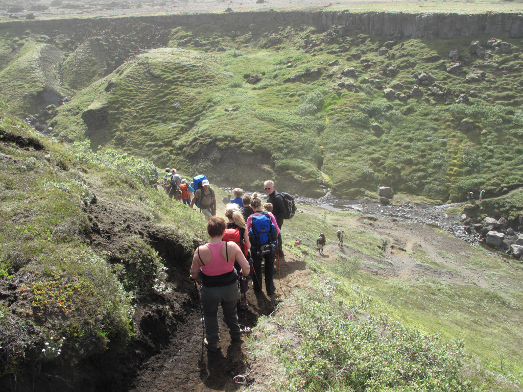
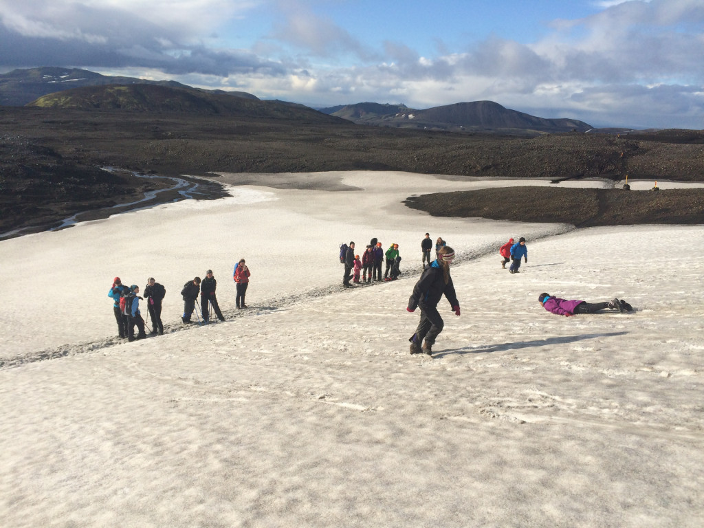
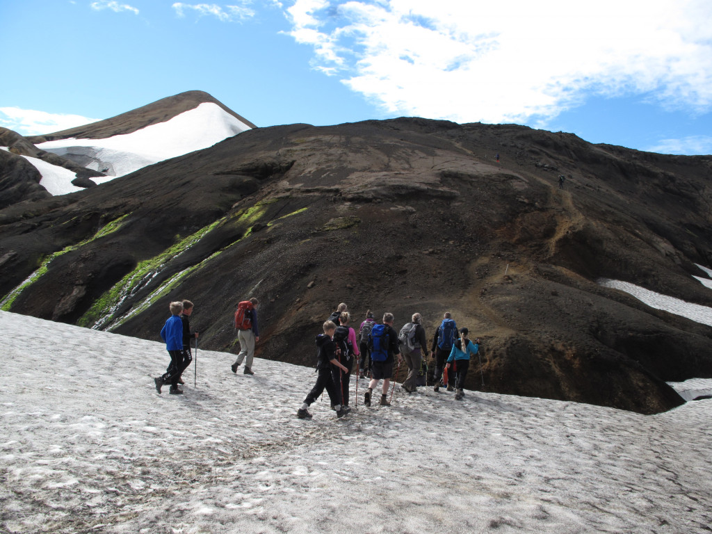
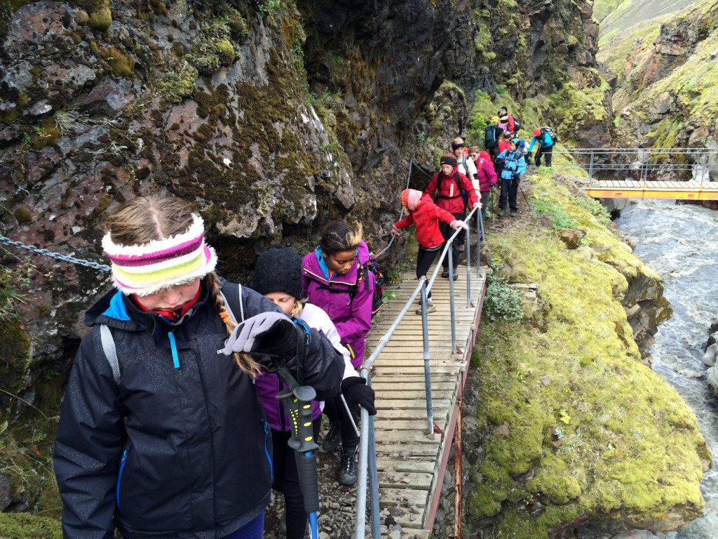
Your Laugavegur journey starts in Landmannalaugar, a geothermal wonderland known for its colorful rhyolite mountains and soothing hot springs. This popular starting point is often bustling with hikers, creating a lively atmosphere as you prepare to set off. As you leave the campsite behind, you'll quickly find yourself immersed in the beauty of the Icelandic highlands.
The path winds through the Laugahraun lava field, where you'll see the contrast between the black lava and the vibrant green moss. The further you hike, the more the crowds thin out, and the sense of being alone in nature becomes more pronounced.
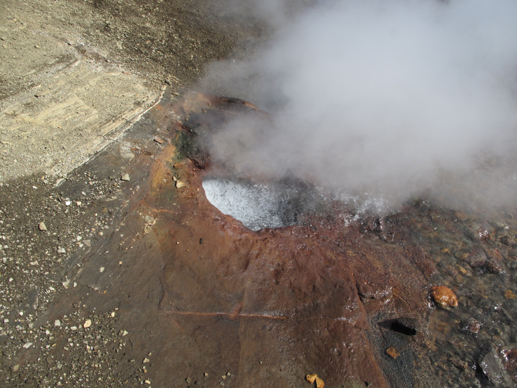
You will traverse fields of obsidian and encounter steaming vents, offering a dramatic introduction to the Laugavegur trail.
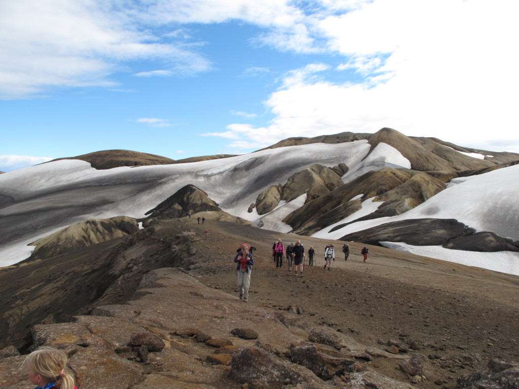
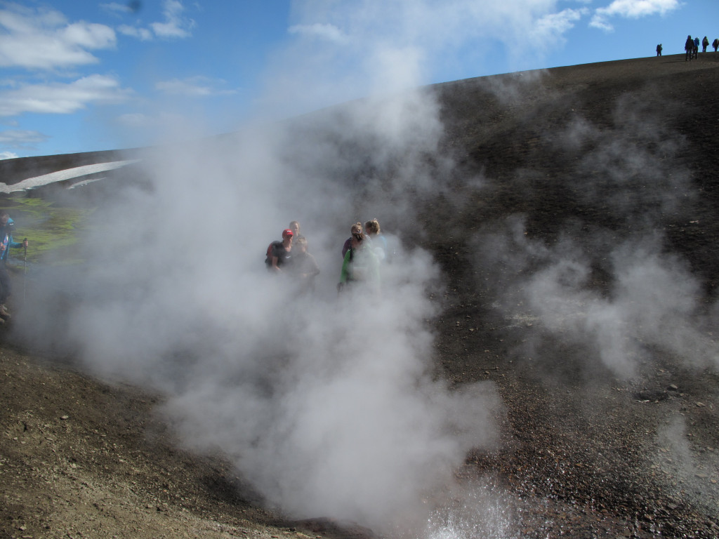
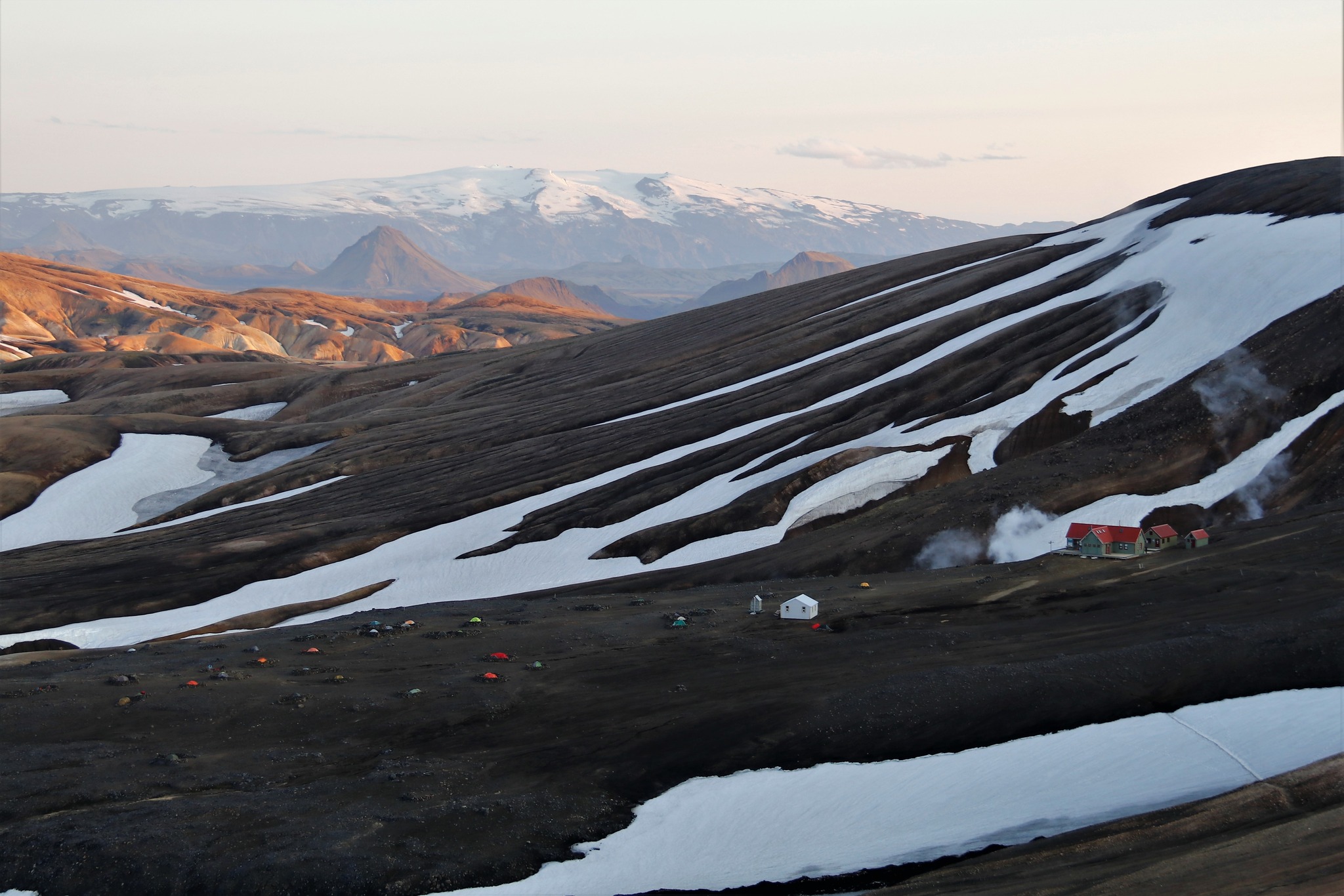
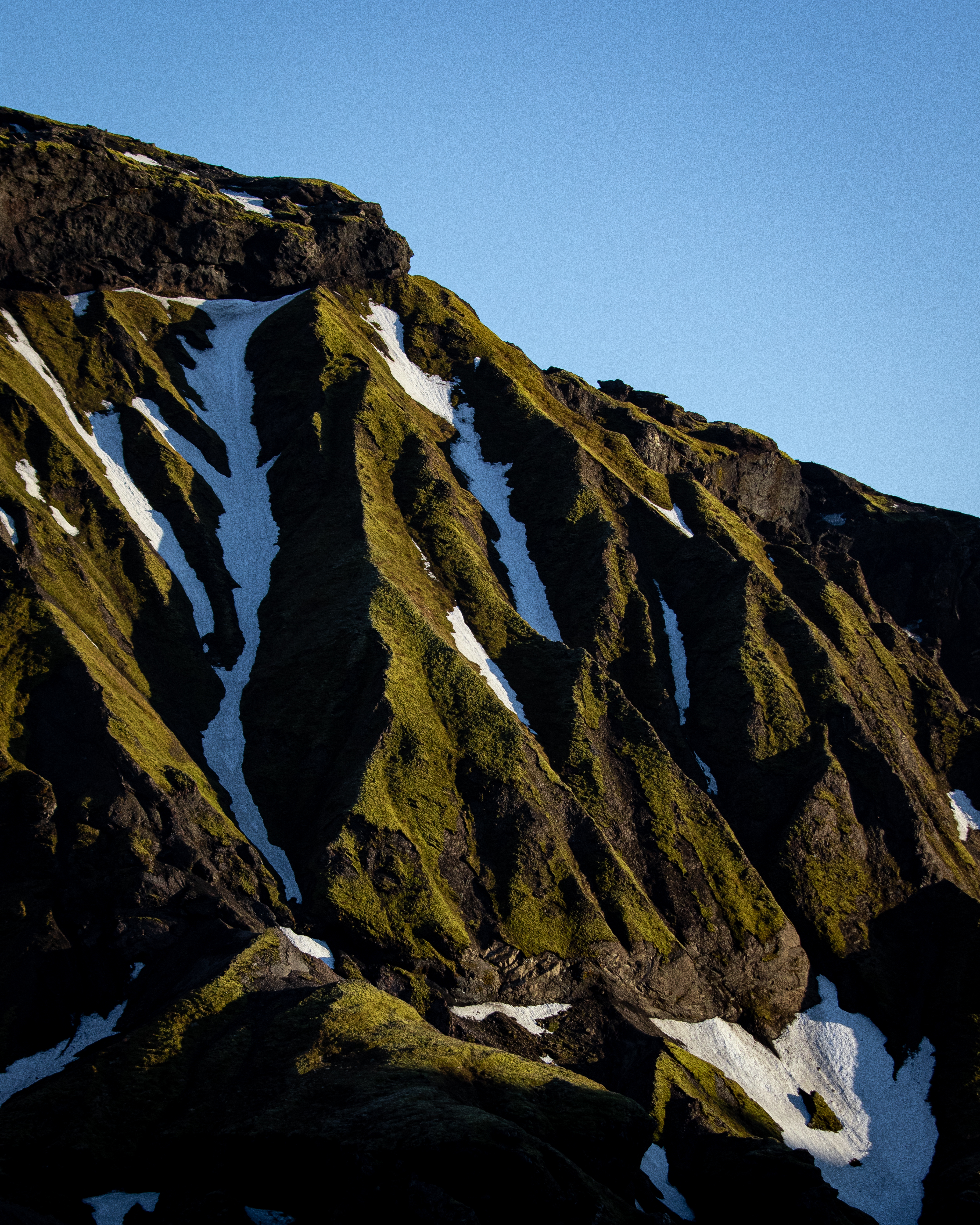
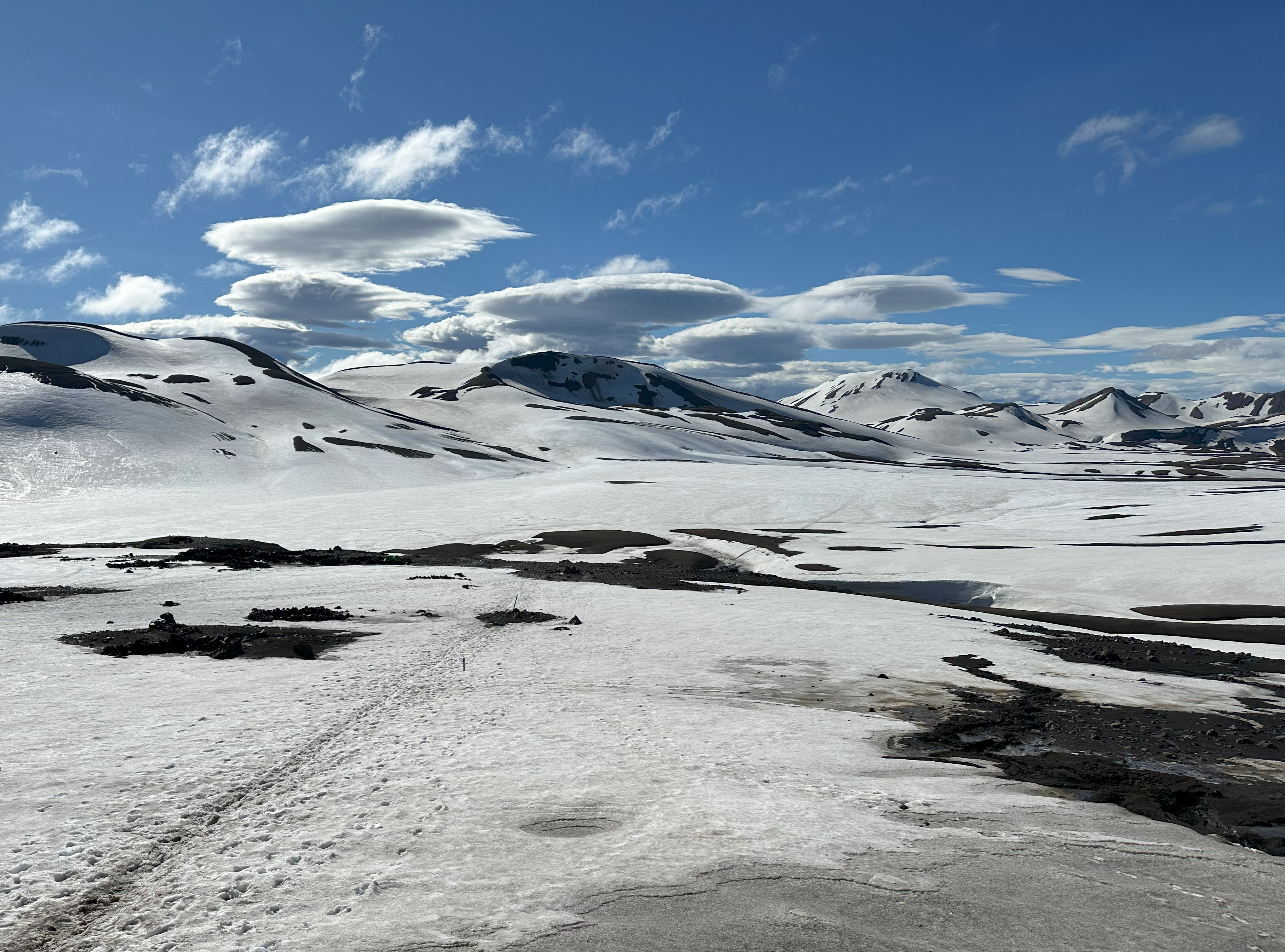
The landscape is unique, with the geothermal activity creating a surreal and ever-changing environment. As you approach Hrafntinnusker, the terrain becomes more rugged, with patches of snow and active geothermal features adding to the atmosphere.
The weather in this area can be unpredictable, and fog is a common occurrence, so it's essential to follow the trail and way markers carefully.
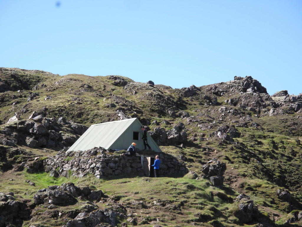
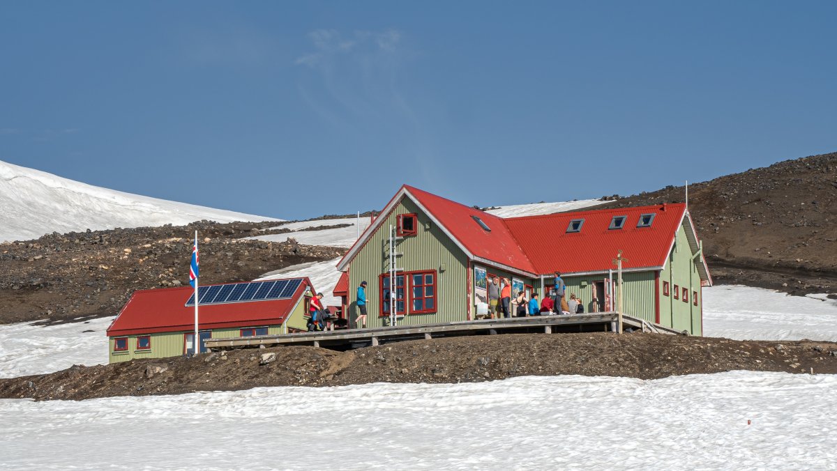
Hrafntinnusker Accommodation
- The hut: Höskuldsskáli hut in Hrafntinnusker accommodates 52 people, in bunk beds and mattresses on the sleeping loft. The kitchen is equipped with gas stoves, utensils and cold running water. The hut is surrounded by a patio, which connects to the latrine.
- The campsite: Depending on when you’re there, you’ll camp on snow or sand and gravel. There is a shelter on the campground for campers to cook and eat. There is a latrine on the campgrounds.
Garbage disposal: You will need to carry your garbage to the next hut.
Things to do in Hrafntinnusker
Söðull hike:
Distance: Approximately 1 km (round trip)
Duration: About 30 minutes to 1 hour
Difficulty: Moderate
Description: The Söðull side hike is a short unmarked trail to a high vantage point near the Hrafntinnusker hut. The trail leads up a small hill, offering panoramic views of the rhyolite mountains, obsidian fields, and snow patches that characterize this part of the trail. It's a moderate ascent, perfect for those wanting to explore without committing to a longer hike. The views from Söðull are stunning, showcasing the rugged beauty of the Icelandic highlands.
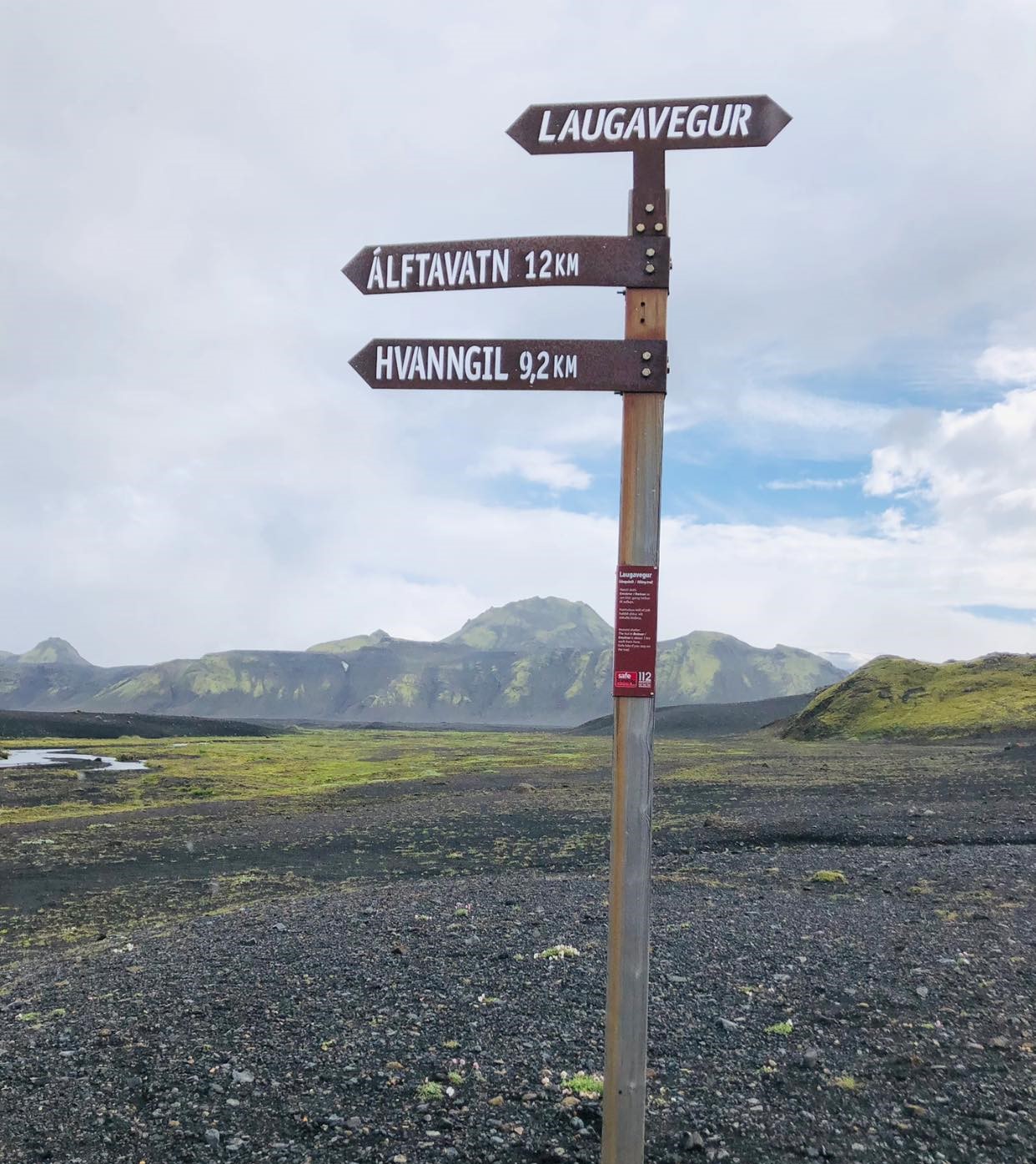
Hrafntinnusker - Álftavatn
12km. 4-5 hours. 490m descent.
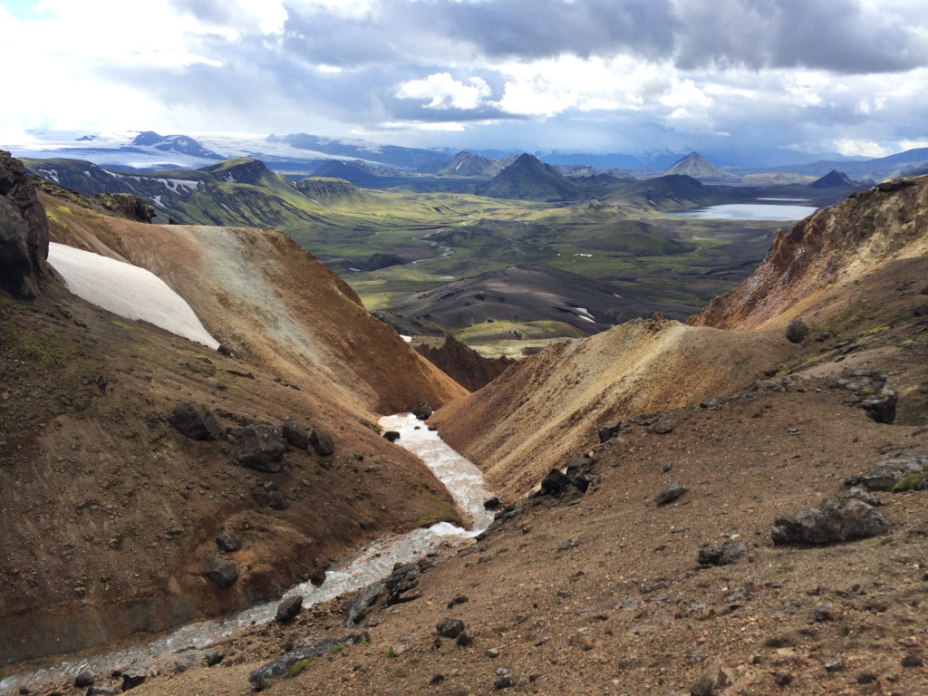
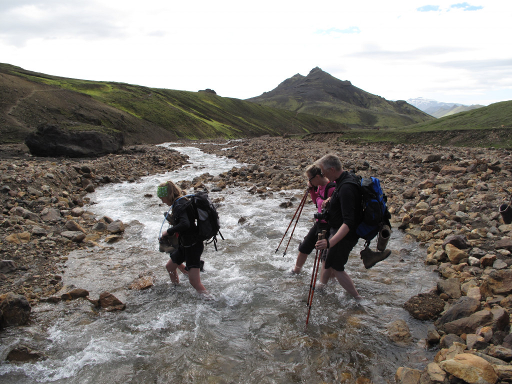
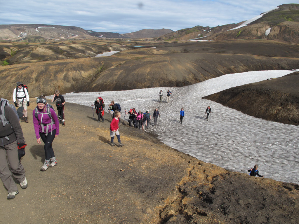
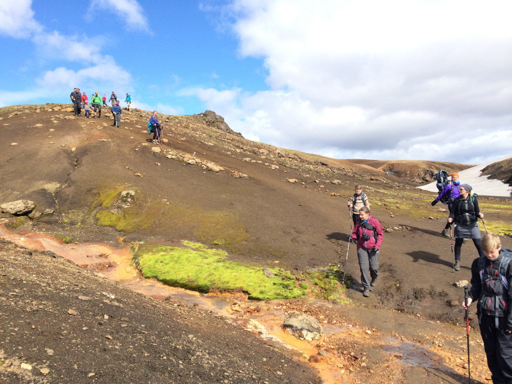
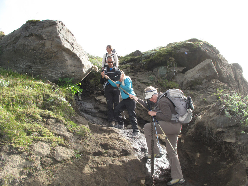
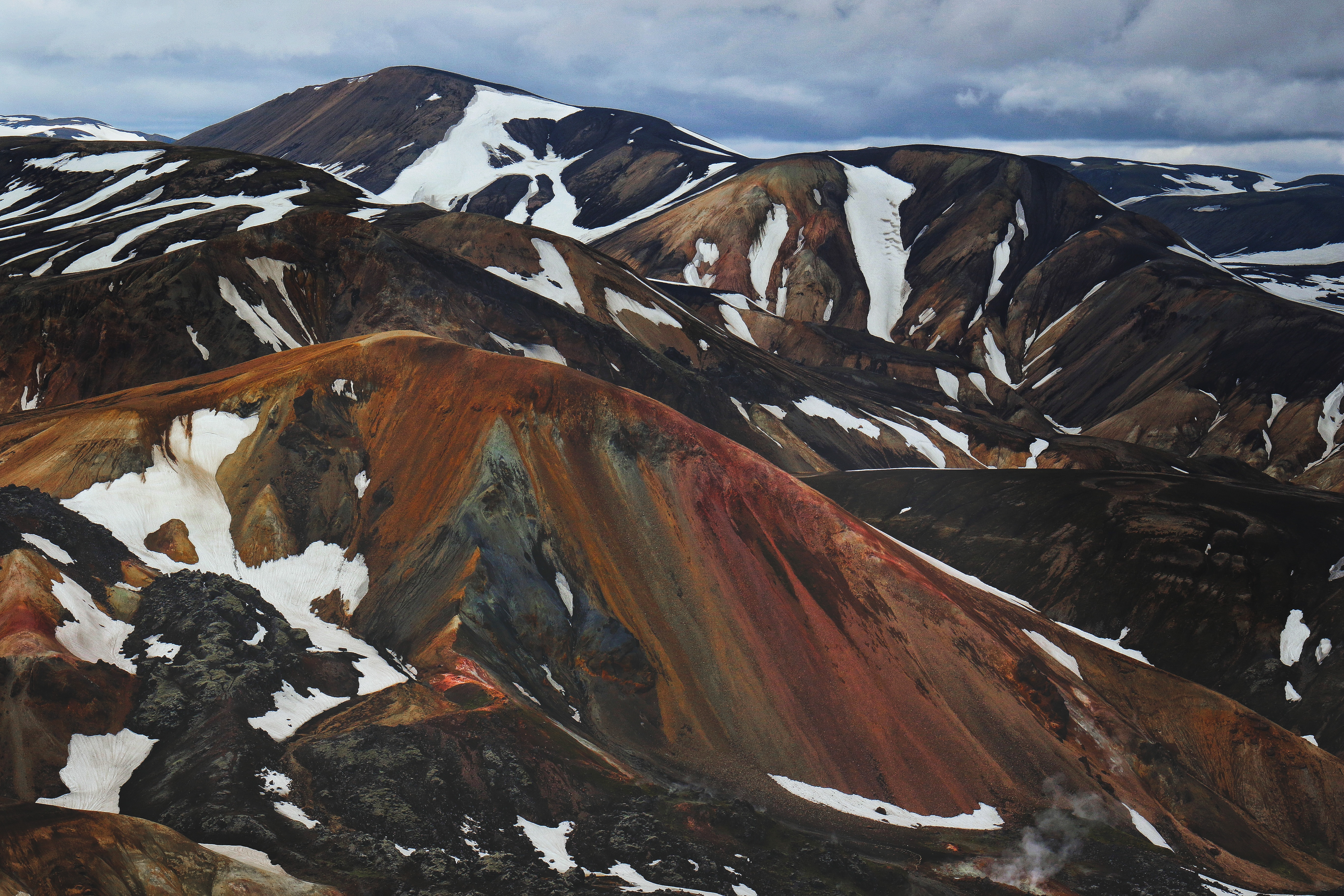
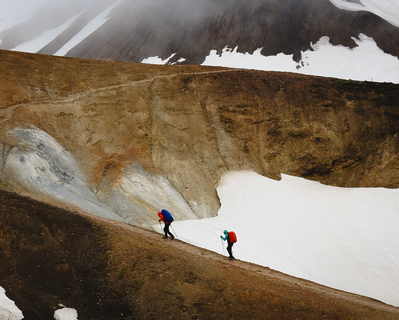
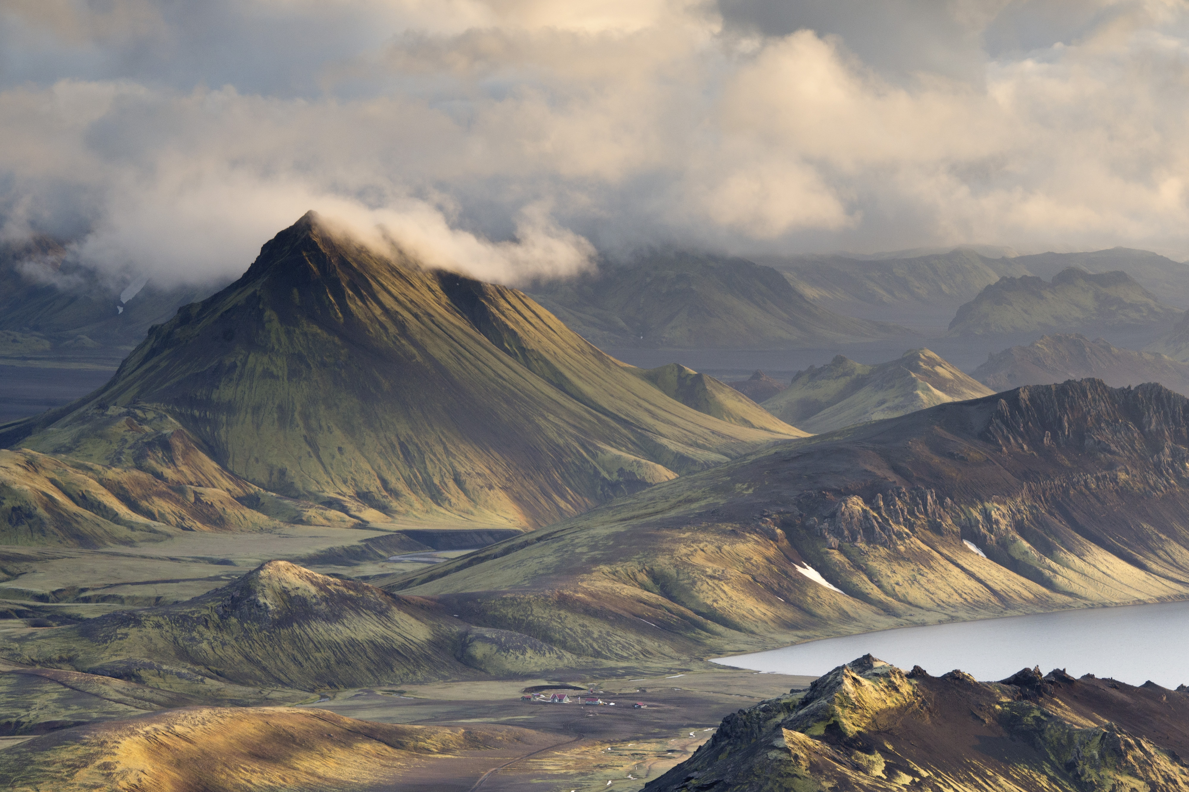
Leaving Hrafntinnusker, the trail follows the slopes of Reykjafjöll, where you'll encounter numerous snow-filled ravines. The ravines are full of colorful rock formations and patches of snow that often melt faster from below, creating thin snow bridges. Hikers must cross these carefully, as the snow can be unstable.
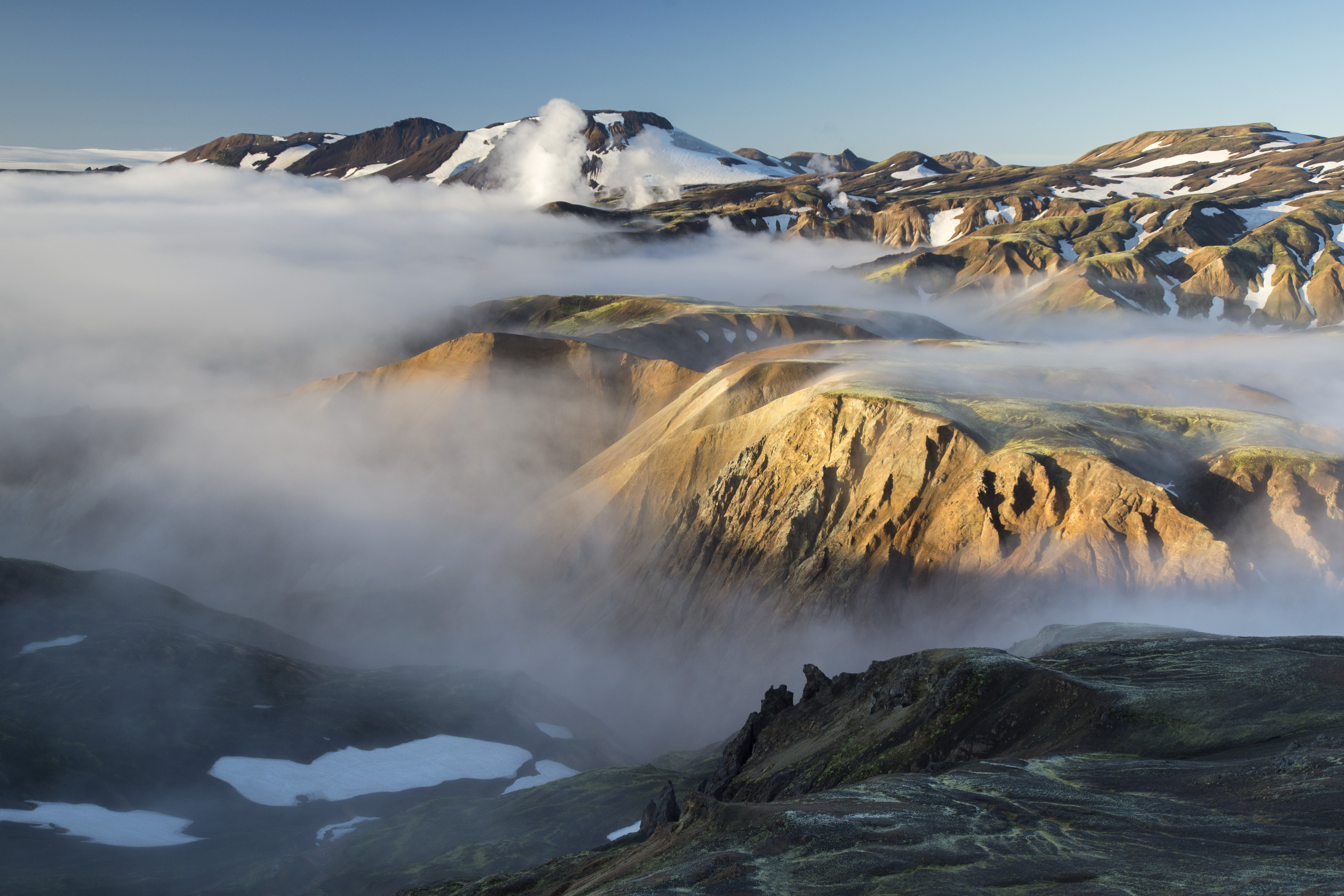
The weather in this area can change rapidly and dramatically. One moment you might have clear skies, and the next, you could be enveloped in thick fog or hit by sudden rain or snow showers. It's essential to be prepared for these abrupt changes by wearing layers and carrying waterproof gear. Visibility can drop quickly, so always follow the trail markers closely to avoid getting lost.
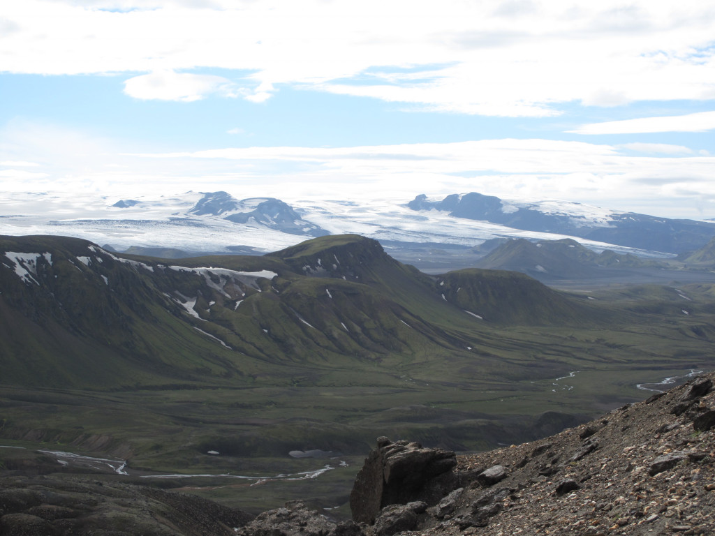
As you continue along Kaldaklofsfjöll, you'll pass more colorful ravines and reach the edge of Jökultungur. If the weather is clear, this is one of the best viewpoints on the trail, where you can see three glaciers: Mýrdalsjökull, Eyjafjallajökull, and Tindfjallajökull.
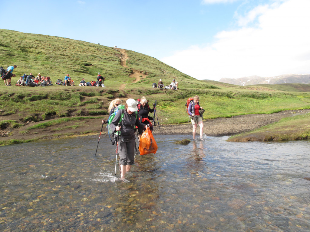
The descent from Jökultungur is steep and rocky, requiring careful footing. At the bottom of the descent, you'll reach the Grashagakvisl river. In early summer, the river can sometimes be crossed on snow bridges, but it is usually crossed by wading on foot. The rest of the way to Álftavatn is mostly flat, providing a welcome break after the challenging descent.
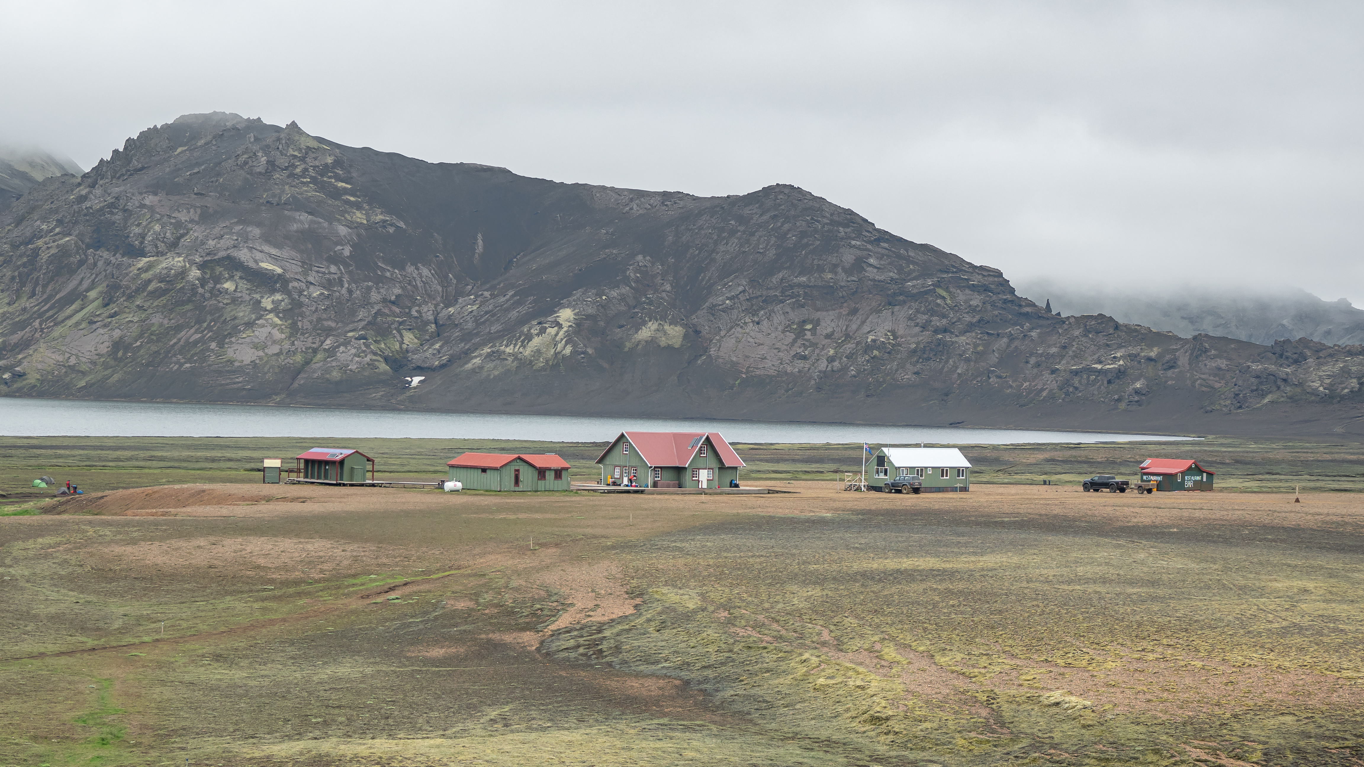
Álftavatn accommodation
- The hut: The two huts in Álftavatn accommodate 72 people in total. Both are equipped with gas stoves, utensils and cold running water in the kitchens. The huts are connected by a patio which also connects to the bathrooms and showers.
- The campsite: You’ll struggle to find a more scenic campsite than the one in Álftavatn. The campgrounds are not far from the hut. There are sinks where people can get drinking water and clean dishes. The bathrooms are located by the huts and shared with hut guests.
Garbage disposal: You can throw away your garbage in Álftavatn.
Things to do in Álftavatn
Brattháls hike:
Distance: Approximately 5,5 km (round trip)
Duration: About 1,5 to 2 hours
Difficulty: Moderate
Description: The Brattháls side hike is a short unmarked trail that takes you to a high vantage point overlooking Álftavatn lake. The trail leads you up a small hill, providing a fantastic opportunity to take in the panoramic views of the surrounding landscape. From the top, you can see the vast expanse of the moss-covered mountains that characterize this part of the trail.
The hike is relatively short but involves a moderate ascent, making it a great option for those looking to explore more of the area without committing to a longer hike.
Álftavatn - Emstrur
16 km. 6-7 hours. 40m descent.
The journey from Álftavatn to Emstrur is a fascinating segment of the Laugavegur trail, characterized by the black sands of Mælifelssandur and several river crossings. Leaving Álftavatn, the trail crosses the Bratthálskvísl river early on.
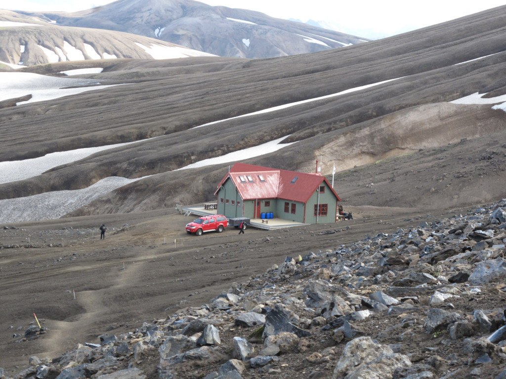
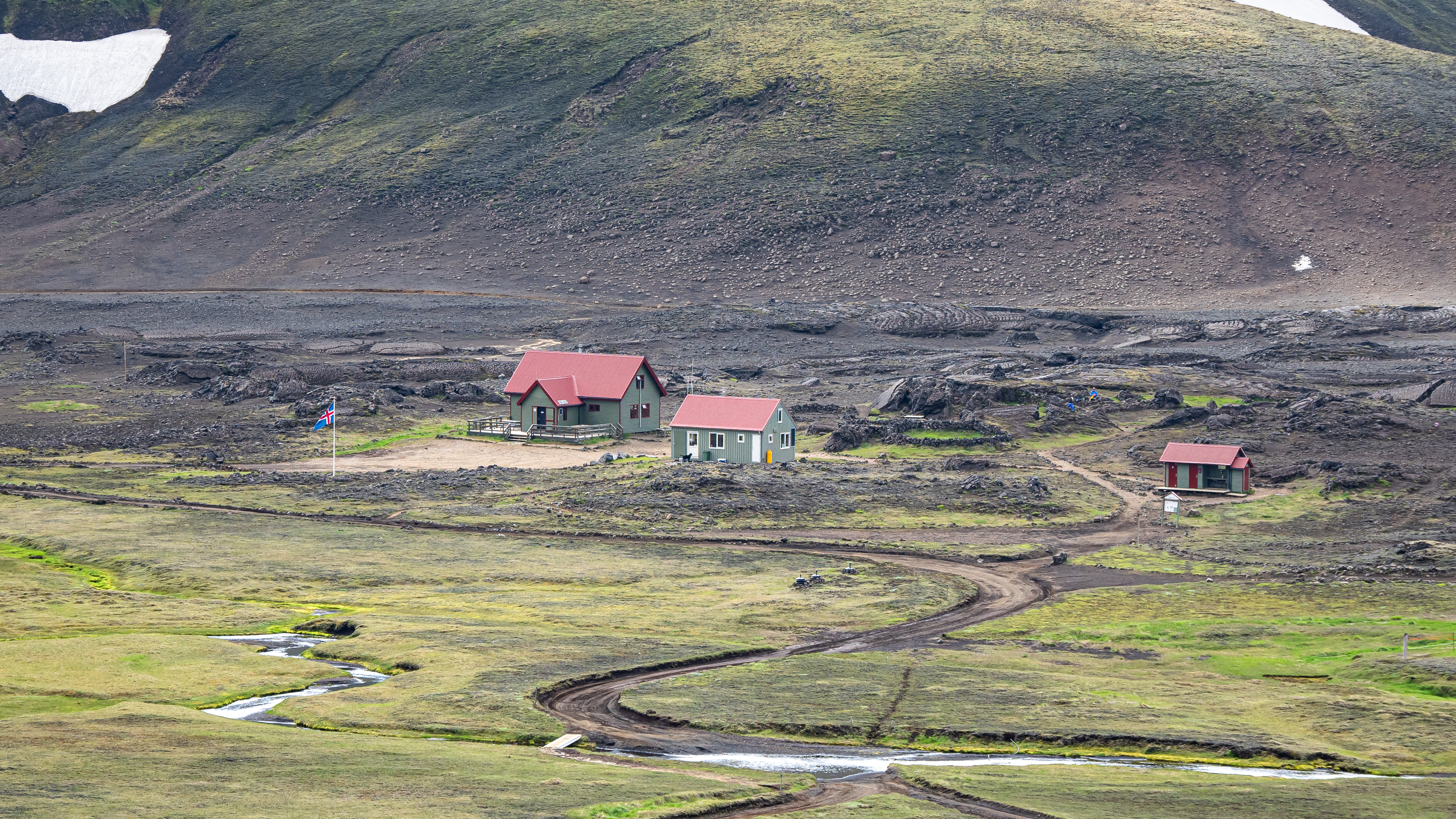
Shortly after, you'll reach Hvanngil, a small hut that some hikers prefer to stay in instead of Álftavatn. The Hvanngil hut provides a cozy refuge and is a good alternative for those looking to break up the journey.
Hvanngil accommodation
- The hut: Hvanngil hut accommodates 60 people. The kitchen is equipped with gas stoves, utensils and cold running water. The hut is surrounded by a patio, which connects to the bathrooms and showers.
- The campsite: There are two areas for camping in Hvanngil. You can choose to stay in the lava field, getting great shelter from the wind or in a grassy area around 200m from the hut. Both areas are near bathrooms.
Garbage disposal: You can throw away your garbage in Hvanngil.
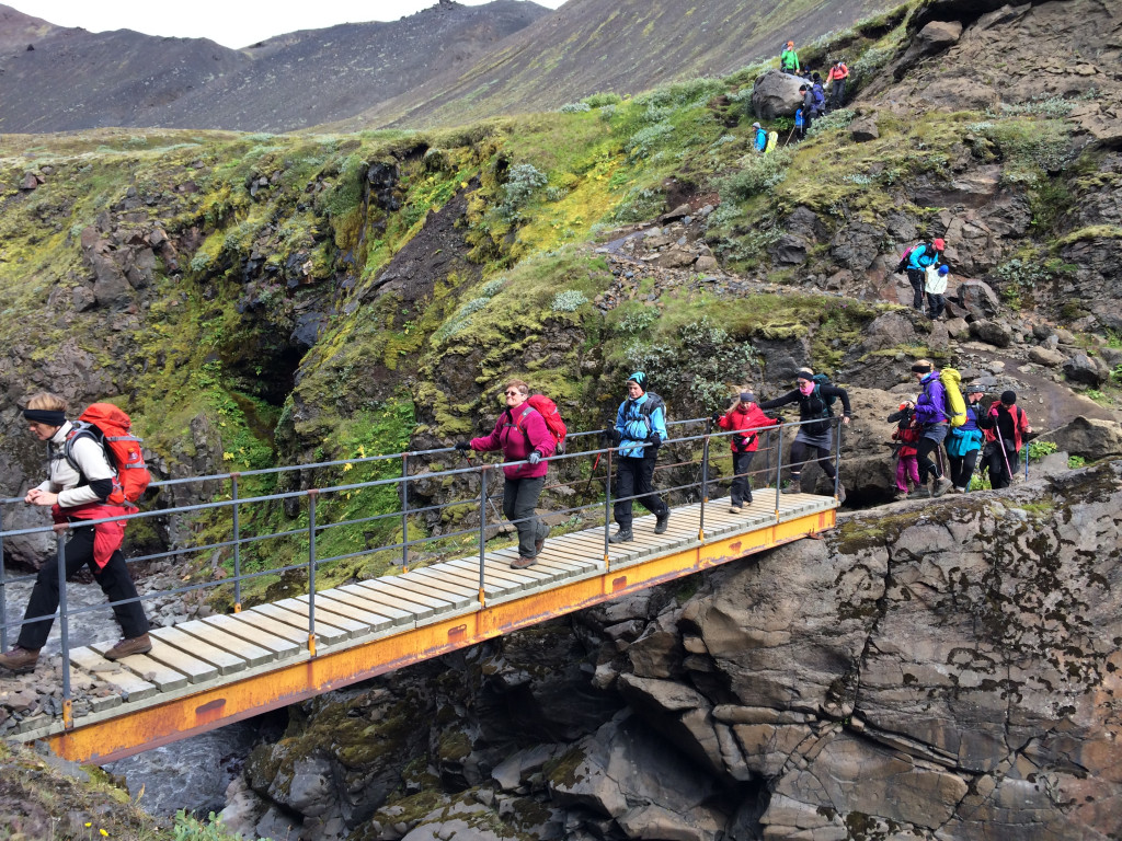
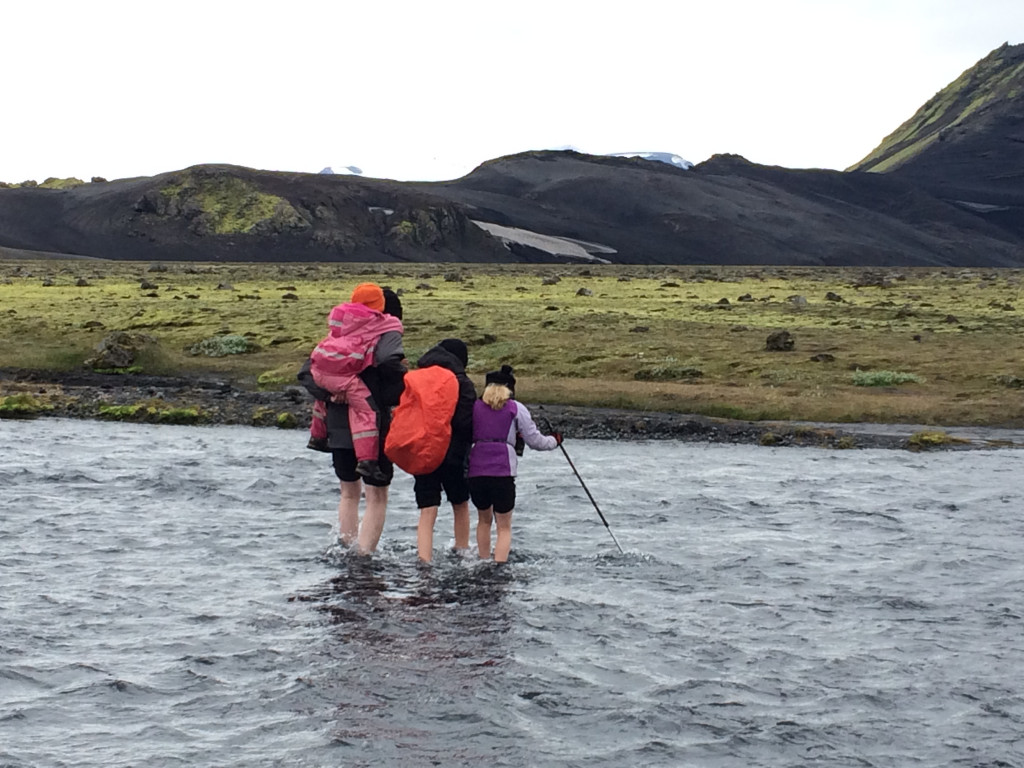
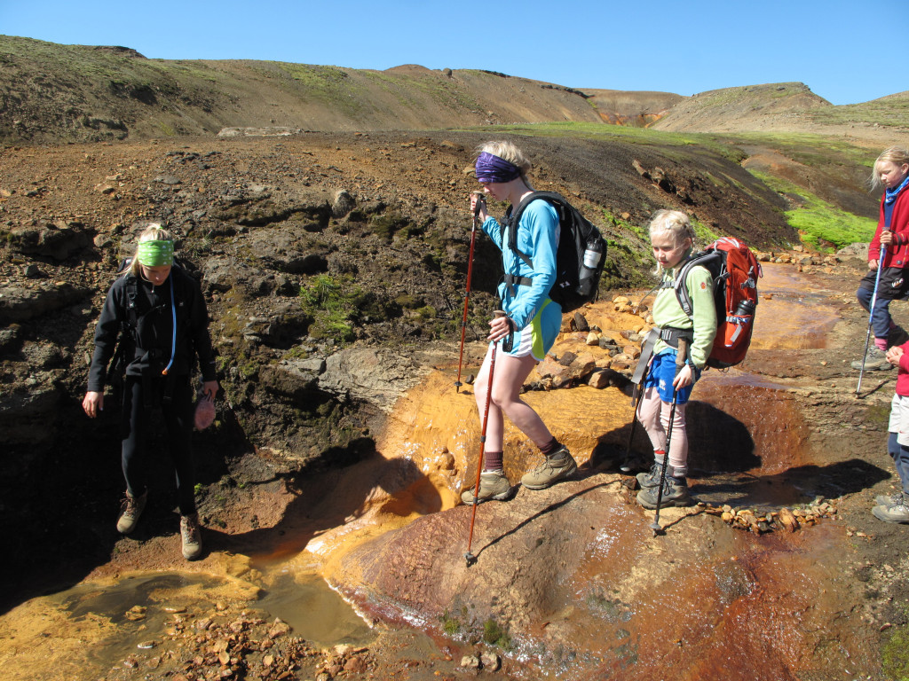
From Hvanngil, the trail leads to a footbridge over the Kaldaklofskvísl river. Shortly after, you'll encounter the Bláfjallakvísl river, which needs to be crossed on foot. This crossing can be challenging, especially after rain, as the river often grows in size.
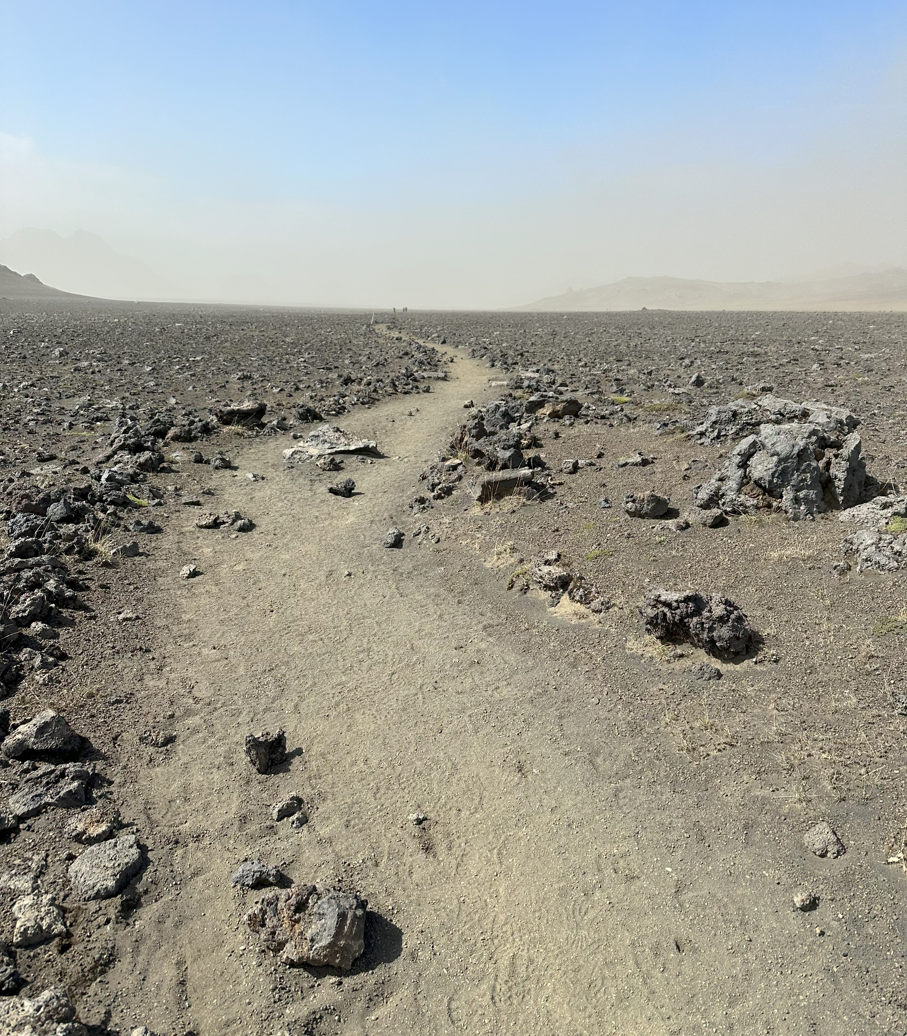
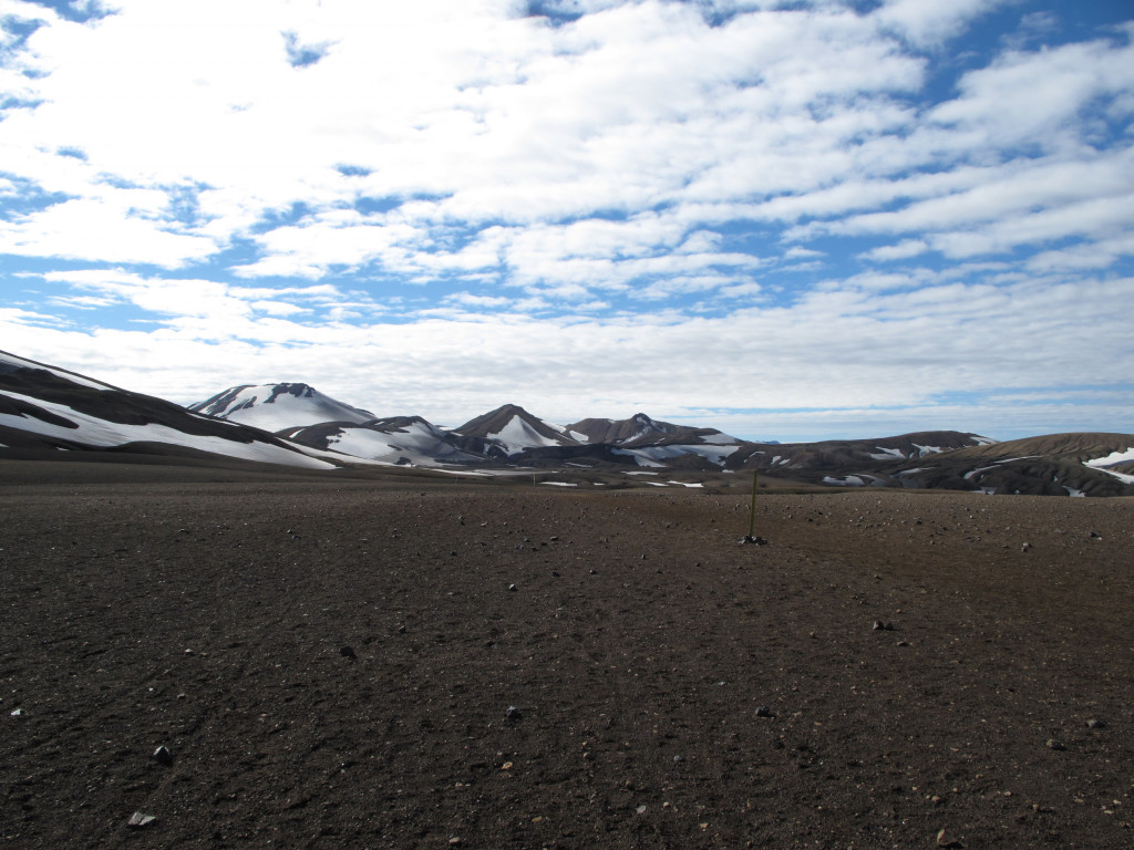
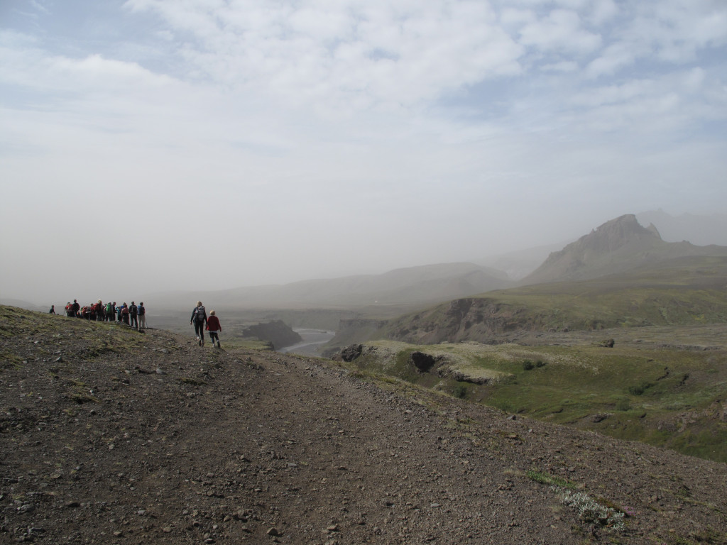
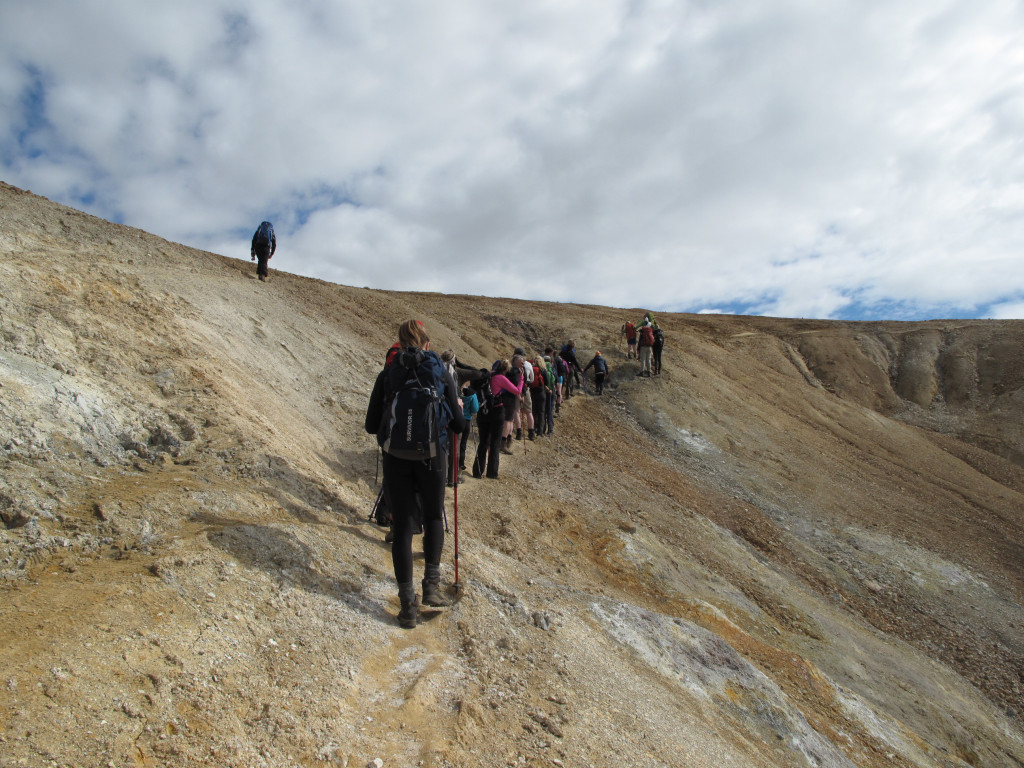
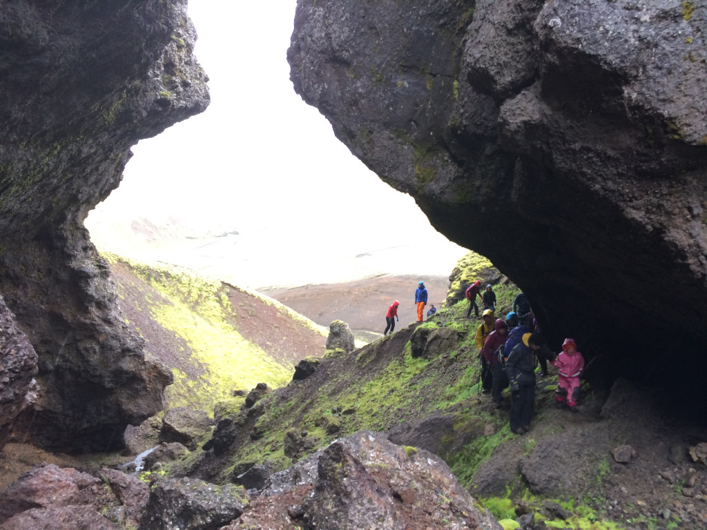
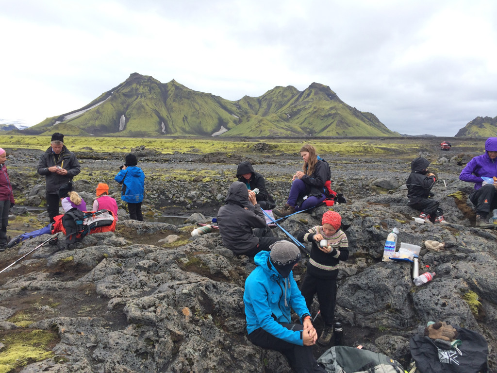
As you continue, the landscape transforms into the black sand deserts of Mælifellssandur. One of the key challenges of this segment is the lack of shelter from the elements. The open, exposed terrain offers little protection from wind, rain, or sun, making it essential to be well-prepared for varying weather conditions. Strong winds often whip up sand and make conditions more challenging.
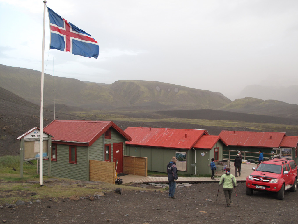
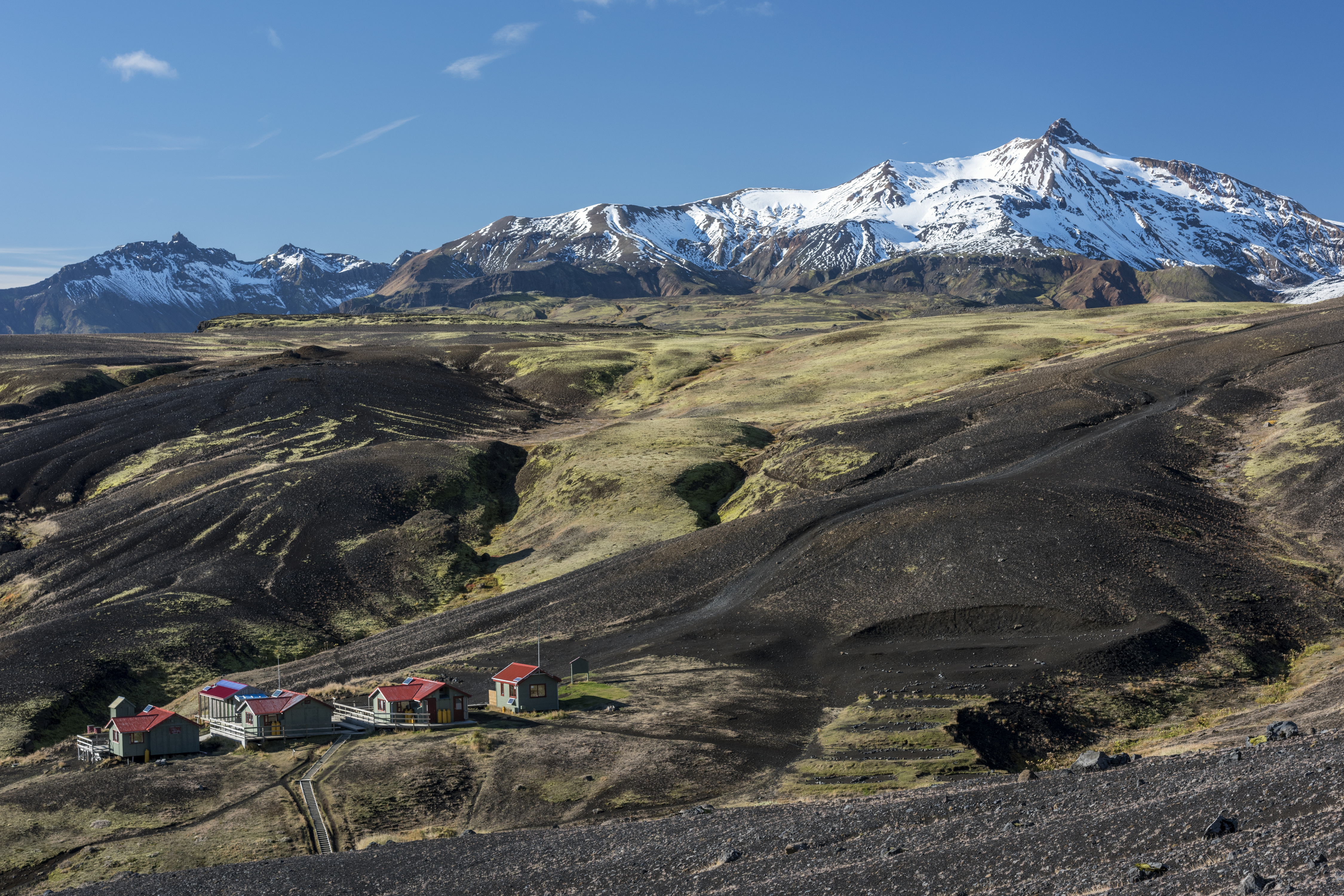
Closer to Emstrur the terrain is rugged, with deep canyons and moss-covered hills adding to the dramatic scenery. The Botnar hut in Emstrur offers a welcome rest, with views of the surrounding canyons and distant glaciers. The hut is not visible until you are quite close.
Emstrur accommodation
- The hut: The three huts in Botnar accommodate 60 people in total. All the huts fit 20 people in an open layout, with bunk beds, a dining area and the kitchen all in the same room. The kitchens are equipped with gas stoves, utensils and cold running water. The huts are connected by a patio which also connects to the bathrooms and showers.
- The campsite: Surrounding the huts and in a valley below, you’ll find the campgrounds. The bathrooms and showers are shared with hut guests. Campers have access to a communal tent, where they can find shelter for cooking and eating. You will have access to drinking water in the bathroom building.
Garbage disposal: You will need to carry your garbage to the next hut.
Things to do in Emstrur
Markarfljótsgljúfur hike:
Distance: Approximately 4,5 km (round trip)
Duration: About 1-2 hours
Difficulty: Moderate
Description: The hike to Markarfljótsgljúfur is relatively easy. The start of the trail is marked with a sign. It takes you to the edge of the 200 meters deep canyon, with steep cliffs and dramatic scenery. The canyon is a testament to the power of nature, having been carved by the river below.
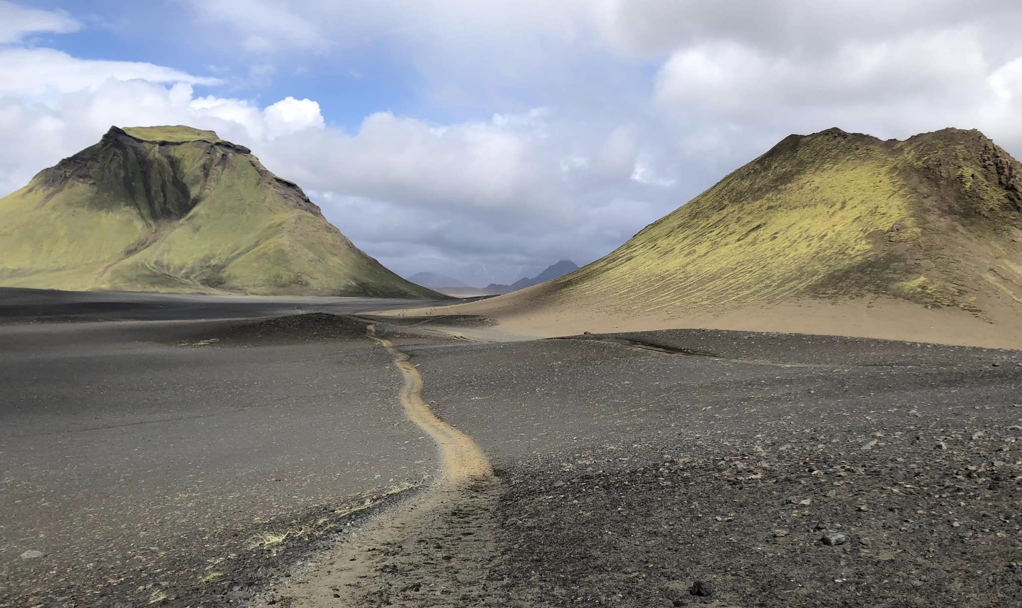
Emstrur - Þórsmörk
15km. 6-7 hours. 300m descent.
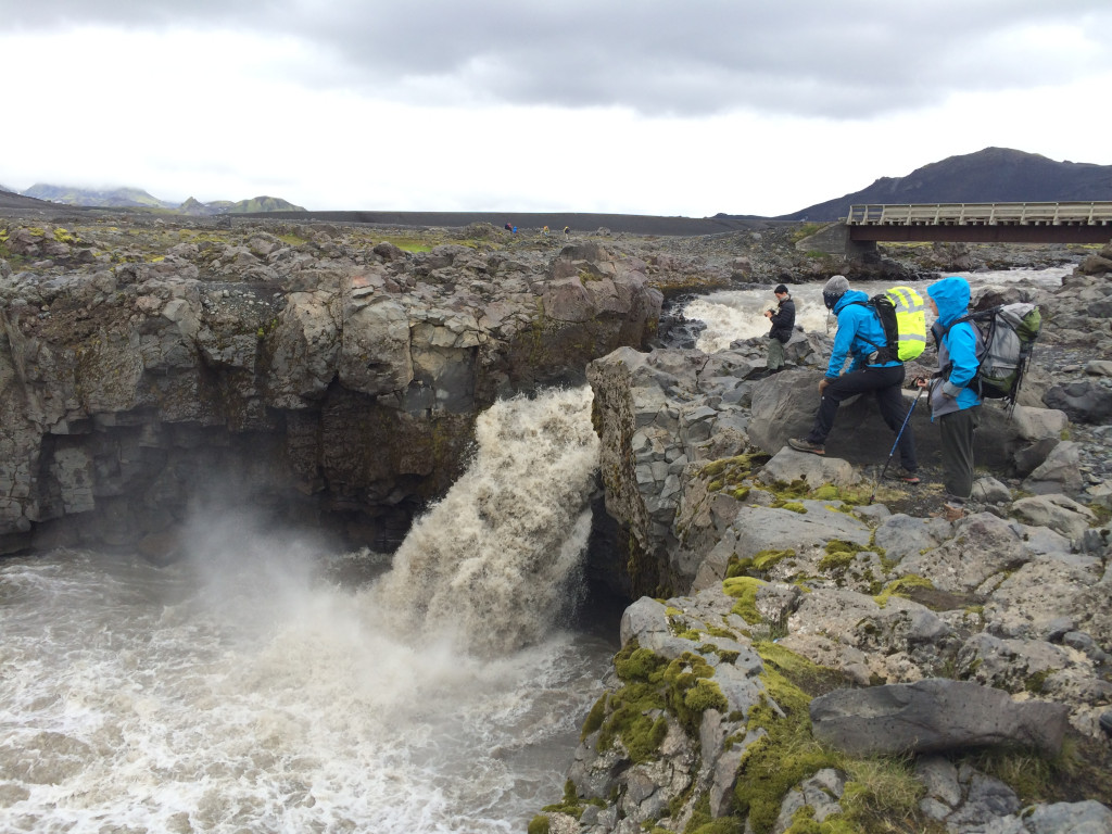
The final segment offers a beautiful conclusion to your adventure, as you traverse a variety of landscapes, from rugged canyons to lush forests. Starting from the Botnar hut in Emstrur, the trail soon drops down towards the Fremri-Emstruá river, which runs through a narrow canyon. You'll cross the river on a footbridge and then climb back up after the crossing.
As you get closer to Þórsmörk, you'll see more vegetation. There are two more rivers to cross: Ljósá, which has a footbridge, and Þröngá, which you cross on foot. Þröngá can be tricky to ford, especially after rain, as the water level can rise quickly. The river bed is often rocky, so be careful when crossing. After crossing Þröngá, the trail continues through the lush foliage of Þórsmörk. You'll pass through the Hamraskógar forest, a beautiful area with dense birch trees and vibrant flora. The trail finally drops down into Langidalur valley in Þórsmörk, where the Laugavegur trail ends.
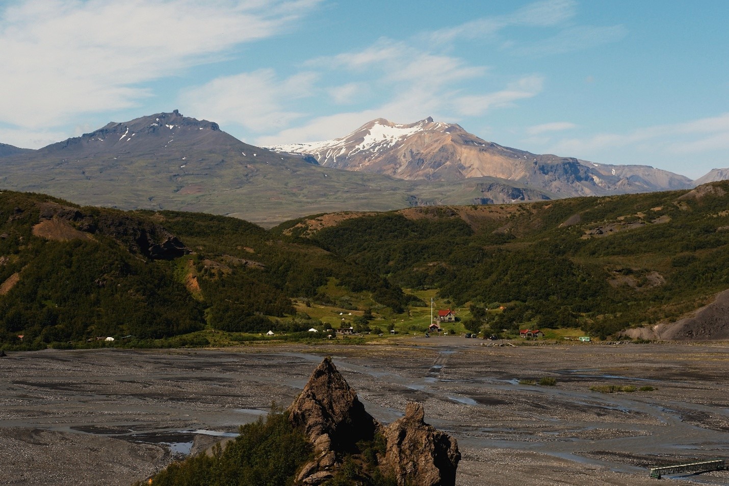
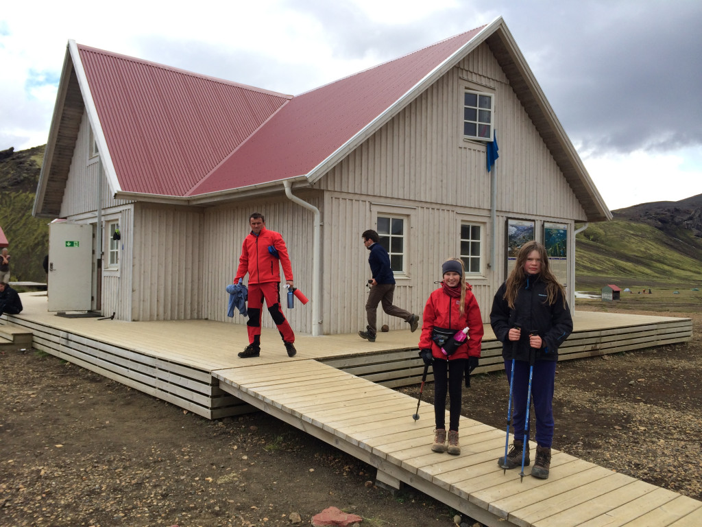
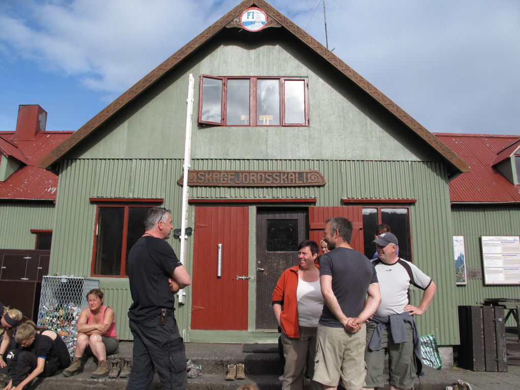
Þórsmörk accommodation
- The hut: Skagfjörðsskáli in Þórsmörk accommodates 73 people. The kitchen is on the bottom floor, where you’ll also find a nice dining area. The kitchens are equipped with gas stoves, utensils and cold running water. The bathrooms and showers are located outside the hut.
- The campsite: Camping in the Langidalur valley is very different to the other campsites on the trail. You’ll be camping in a grassy forest, with great views. The bathrooms are shared with hut guests.
Garbage disposal: You can throw away your garbage in Þórsmörk.
Things to do in Þórsmörk
Valahnúkur
- Distance: 4km
- Time: 1-2 hours
- Difficulty: Moderate
- Desciption: The hike to Valahnúkur is relatively easy. The trail climbs out of the forest and rewards you with spectacular views at the summit. This hike is perfect if you're looking for a short hike or are short on time
Tindafjöll circle
- Distance: 9km
- Time: 3-4 hours
- Difficulty: Challenging
- Description: The Tindafjöll Circle is renowned for its panoramic views and is a favorite among hikers seeking to experience the beauty of Þórsmörk. You'll encounter varied landscapes, including lush greenery, volcanic mountains, and views of glacial rivers.
Rjúpnafell
- Distance: 15km
- Time: 6-7 hours
- Difficulty: Very challenging.
- Description: This hike is perfect for experienced hikers looking for a challenging and scenic adventure in Þórsmörk. The trail breaks off from the Tindafjöll Circle about midway. From there, it takes you through ravines and steep hills. The path involves tight zigzags up the steep face of Rjúpnafell, making it both physically and mentally demanding. However, the views from the summit are magnificent, offering panoramic views of the surrounding Þórsmörk valley, glaciers, and mountains.
Réttarfell
- Distance: 8km
- Time: 3-4 hours
- Difficulty: Challenging
- Description: This hike is perfect for those looking to experience the diverse terrain and vibrant colors of Þórsmörk. You'll start by crossing the footbridge over Krossá and heading to Básar camp. From there, the trail takes you through a gorge and up to a ridge, offering stunning views of the river valley and surrounding landscapes. At the summit of Réttarfell, you'll be treated to breathtaking panoramic views of Eyjafjallajökull and the Þórsmörk valley.
Fimmvörðuháls trail and alternative itineraries
The Laugavegur trail is most popularly hiked over four days. This duration allows hikers to really take in the diverse landscapes. However, many adventurers opt for a faster pace, completing the trail in three or even two days, which can be more physically demanding but equally rewarding. We’ve listed some common ways of completing the trail below.
For those looking to extend their adventure, adding the Fimmvörðuháls trail is a fantastic option. This extension takes hikers through the dramatic pass between the glaciers Eyjafjallajökull and Mýrdalsjökull, offering even more spectacular views and unique geological features. Combining both trails provides an unforgettable experience, blending the best of Iceland's natural beauty into one journey.
Common four-day itineraries
- Day 1: Landmannalaugar to Hrafntinnusker - 12 km
- Day 2: Hrafntinnusker to Álftavatn - 12 km
- Day 3: Álftavatn to Emstrur - 17 km
- Day 4: Emstrur to Þórsmörk - 15 km
- Day 1: Landmannalaugar to Hrafntinnusker - 12 km
- Day 2: Hrafntinnusker to Hvanngil - 16km
- Day 3: Hvanngil to Emstrur - 13 km
- Day 4: Emstrur to Þórsmörk - 15 km
Common three-day itinerary
- Day 1: Landmannalaugar to Álftavatn - 24 km
- Day 2: Álftavatn to Emstrur - 17 km
- Day 3: Emstrur to Þórsmörk - 15 km
Common two-day itinerary
- Day 1: Landmannalaugar to Hvanngil - 28 km
- Day 2: Hvanngil to Þórsmörk - 28 km
Laugavegur and Fimmvörðuháls itinerary
- 2, 3 or 4 days on Laugavegur, finishing in Þórsmörk - 56 km
- Þórsmörk to Baldvinsskáli - 15 km
- Baldvinsskáli to Skógar - 12 km
Book accommodation
Due to the popularity of the trail and the limited number of beds available, the huts often sell out quickly, especially during the peak hiking season. Booking ahead ensures you have a guaranteed place to stay each night of your trek.
The huts provide basic dormitory-style accommodations with shared facilities, including kitchens and bathrooms. They are well-maintained and staffed by wardens who can assist with any needs during your stay
Enquire about Laugavegur huts 2025: Enquire
How do I get there?
Landmannalaugar
- To start your hike, you'll need to get to Landmannalaugar. The most common way to reach Landmannalaugar is by taking a bus from Reykjavík. Several companies offer bus services during the hiking season (late June to early September).
- If you plan to drive to Landmannalaugar, you must have a 4x4 vehicle authorized by your rental car company to be driven on F-roads. There is a parking fee for vehicles at the Landmannalaugar parking area.
Þórsmörk
- After finishing your hike, the best way to get back from the Highlands is to take a bus. Several companies offer bus services during the hiking season (late June to early September).
Skógar
- If you choose to extend your hike across Fimmvörðuháls pass there are two options of getting back to Reykjavík. You can take a bus with Reykjavík Excursions or choose to take the public bus, Strætó. Route no. 51 stops in Skógar and will take you to Reykjavík.
Equipment, safety and planning
Hiking the Laugavegur trail is an adventure. However, the key to a safe and enjoyable experience lies in thorough preparation. Proper gear is essential; the unpredictable Icelandic weather demands high-quality, waterproof clothing, sturdy hiking boots, and a reliable backpack. Additionally, planning your route and understanding the terrain can prevent mishaps and ensure you stay on track. Preparation also includes packing sufficient food, water, and emergency supplies. By investing time in these aspects, you not only enhance your safety but also maximize the enjoyment of this breathtaking journey.
Gear
Clothing
- Layered Clothing: The weather can change rapidly, so it's crucial to have layers. Include a moisture-wicking base layer, insulating mid-layer, and a waterproof outer layer.
- Hiking Boots: Sturdy, waterproof boots are essential for the varied terrain, including rocky paths, snow-covered sections, and river crossings.
- Hat and Gloves: For warmth and protection against the elements. A buff or neck gaiter can also be a good idea.
- Socks: High-quality, moisture-wicking socks to keep your feet dry and comfortable.
- River crossing shoes: Lightweight sneakers that dry quickly or sandals are a popular choice.
Camping Gear (if camping)
- Tent: Lightweight and weather resistant.
- Sleeping Bag: Suitable for cold temperatures.
- Sleeping Pad: For insulation and comfort.
- Cooking Equipment: Portable stove, fuel, and cooking utensils.
Personal Items
- Backpack: A 50-60L backpack. If camping, you may need to bring a 60-70L pack.
- Water Bottle/Hydration Pack: Staying hydrated is crucial.
- Food: While hiking, you will need more energy than usual. Make sure to have enough food. Here you can see what food is for sale in our huts.
- Navigation: GPS device, map and compass.
- First-Aid Kit: Including blister treatment and any personal medications.
- Multi-tool: Handy for various tasks.
- Headlamp/Torch: For visibility at night.
- Dry Bags: To keep your gear dry.
- Sunglasses and sunscreen: Rain is common in the highlands, but so is sun!
- Toiletries: Toothbrush, toothpaste, soap and perhaps a small towel if you plan to shower. Earplugs may also come in handy.
- Dry clothes: It can rain a lot on the trail and your raingear may not be able to keep up with Icelandic weather. An extra set of dry clothes is recommended.
Miscellaneous Gear
- Trekking Poles: Helpful for stability on uneven terrain.
- Repair kit: If any of your gear is damaged.
- Camera: To capture memories from the trail.
Navigation and trail markings
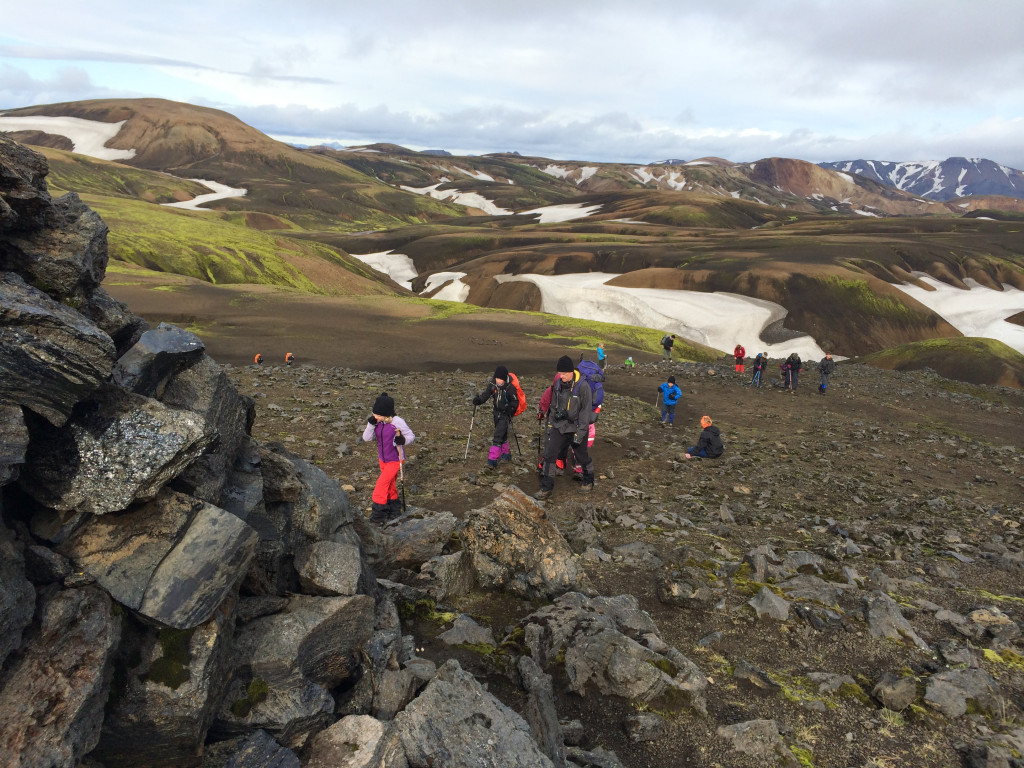
The whole trail is well marked and has enough traffic that the danger of getting lost is minimal. However, in bad weather and fog, when visibility is close to zero, everything will change. This is especially true during the first two parts of the trail, from Landmannalaugar up to Hrafntinnusker and then down towards Álftavatn. This part of the trail sees a lot of fog and bad weather and in early summer this area can also be covered with snow.
Weather
Summer Weather (June to August):
- Temperatures: During the summer months, daytime temperatures typically range from 5°C to 14°C. At night, temperatures can drop to between 0°C and 10°C, depending on where you are on the trail.
- Rain: Rain is common. It's essential to have waterproof gear, including a good rain jacket and waterproof pants.
- Wind: Wind can be a significant factor on the trail. Wind speeds can vary, but anything above 10-12 meters per second can make hiking conditions challenging. Be prepared for strong winds, especially in exposed areas.
Spring and Autumn Weather (May, September):
- Temperatures: Temperatures can be cooler, with daytime highs around 5°C to 10°C and nighttime lows potentially dropping below freezing.
- Rain and Snow: Rain is still common, and there's a possibility of snow, especially at higher elevations. Waterproof and warm clothes are crucial.
- Wind: Wind speeds can be similar to those in summer, so be prepared for strong gusts.
General Tips:
- Check the Forecast: Always check the weather forecast before starting your hike. Reliable sources include the Icelandic Meteorological Office and Blika.
- Be Flexible: Weather conditions can change rapidly, so be prepared to adjust your plans if necessary. It's a good idea to have a flexible itinerary.
- Talk to Wardens: Speak to the wardens at Landmannalaugar before you start and at each campsite along the way. They can provide up-to-date information on weather and trail conditions.
River crossings
While some rivers on the way have footbridge, at least three rivers have to be waded. Generally, they are not difficult to cross but they can grow quickly if it rains much. Be careful and always let the current help you get across.
Phone signal
Phone connection can be unstable on the trail and you might have go to the nearest hilltop to find a network.
You will not be able to connect to WiFi in the huts, but may find a few spots along the trail where a 4G connection is possible.
Emergencies
Emergency Services: In case of an emergency, contact 112. Make sure you have a way to call for help.
When is it open?
Access and passage on the trail vary from year to year depending on weather, snow conditions and when the Icelandic Road Authority opens the roads to Landmannalaugar and other huts along the way (F208/F225/F210).
On average one can assume that the trail is open from June 25 to September 15.
Þórsmörk usually opens sooner or in the beginning of May.
Reading material
The guide booklet Laugavegur Hiking Trail offers good hiking tips and describes each leg of the way plus suggesting some interesting evening hikes from each of the huts along the way.
Fjallabak Nature Reserve is a 160 page book, mainly about the area surrounding Landmannalaugar.
Several maps cover the entire hiking trail, including the special map Þórsmörk Landmannalaugar which is in the scale 1:100 000.
In addition the Landmannalaugar Hiking Map is a detailed, drawn map for those who want to hike around Landmannalaugar.
Last but not least we suggest you take a look at a beautiful photobook of Laugavegur.
All of these books and maps can be bought at the FÍ online store, at the offices of FÍ, Mörkinni 6 in Reykjavík and in the hut in Landmannalaugar. The booklet Laugavegur Hiking Trail and the special map Þórsmörk Landmannalaugar is also available for purchase in other huts on the Laugavegur trail.
Respect the nature
Those who hike Laugavegurinn do so to experience the spectacular nature along the trail. The Icelandic environment is very fragile and all hikers must exercise great care and respect for the nature.
Please stay on the trail, only pitch your tent in designated camping grounds, avoid stepping on the fragile moss or leave marks or trails where there are none. It only takes one set of footprints for many more to follow.
We emphasize that nothing can be left in nature, neither organic leftover food nor toilet paper. The general rule is to leave nothing but footprints on the trail and take nothing but pictures and memories.