Fara í efni
Mountain Huts
All mountain huts
Map of Mountain Huts
About the Huts
Terms and Prices
Hut Rules
Laugavegur huts FAQ
Camping
Food, drinks & snacks
Hiking Trails
Trails
Safety
Icelandic Huts
What to bring?
Landmannalaugar
Þórsmörk and Fimmvörðuháls
Hornbjargsviti
Norðurfjörður
Laugavegur Trail
Books and maps
About Us
About Us
Support our work
Book hut
Sign up for updates
bokunShoppingCart
Open cart
0
Your cart
Close cart
Cart is empty
Íslenska
English
Search
English
/
Books and maps
/
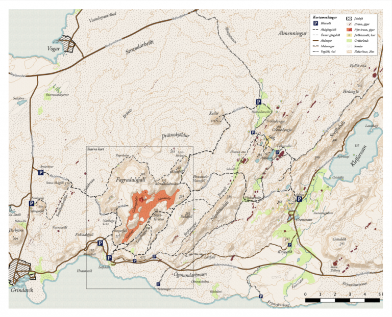
Göngu og Örnefnakort af Geldingadölum
Reference:
505085Raf
Göngu og Örnefnakort af Geldingadölum
Price
incl. tax
2.000
kr.
Quantity
1
2
3
4
5
6
7
8
9
10
11
12
13
14
15
16
17
18
19
20
Price
incl. tax
2.000
kr.
Add to cart
Open/close menu